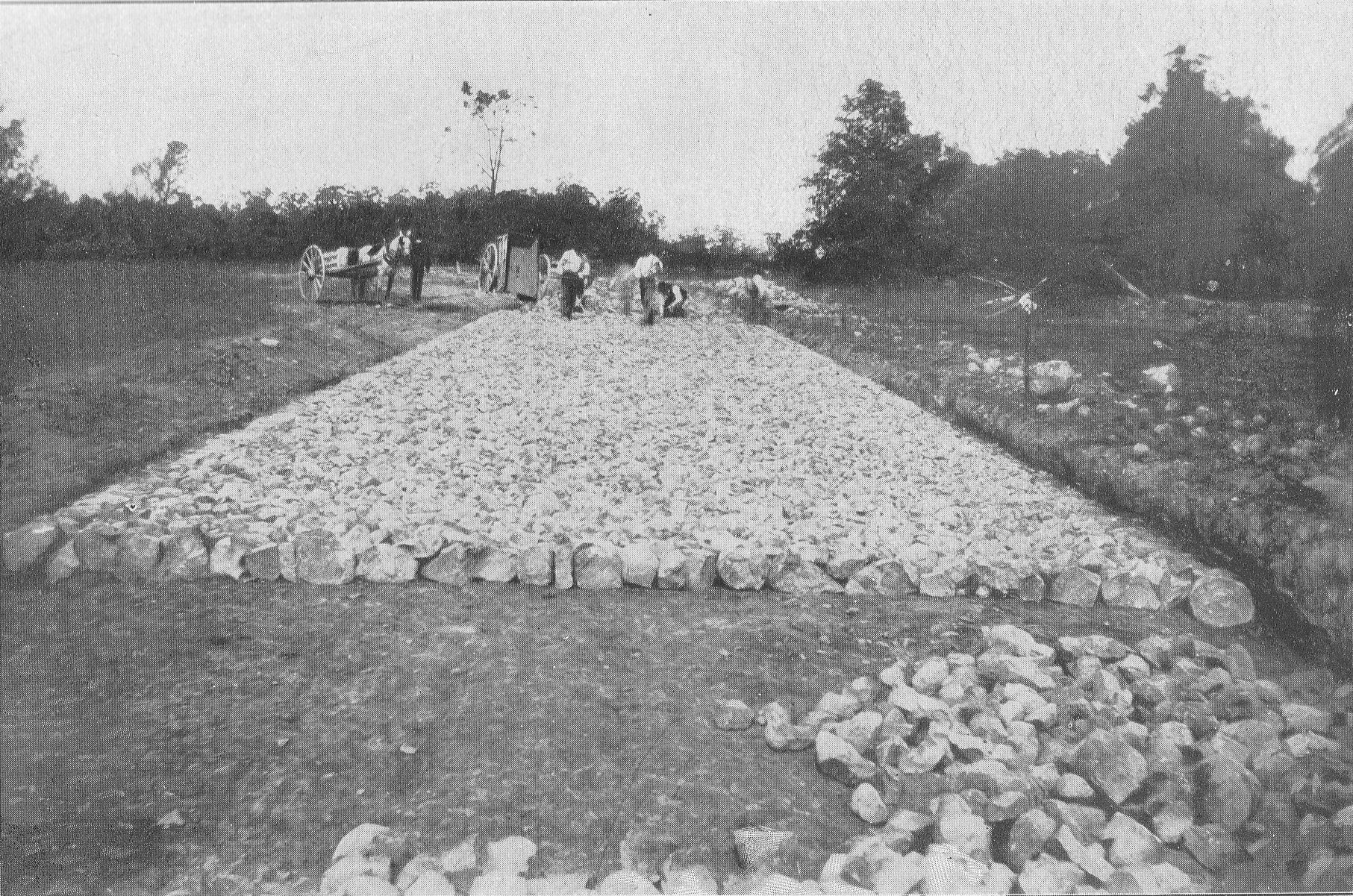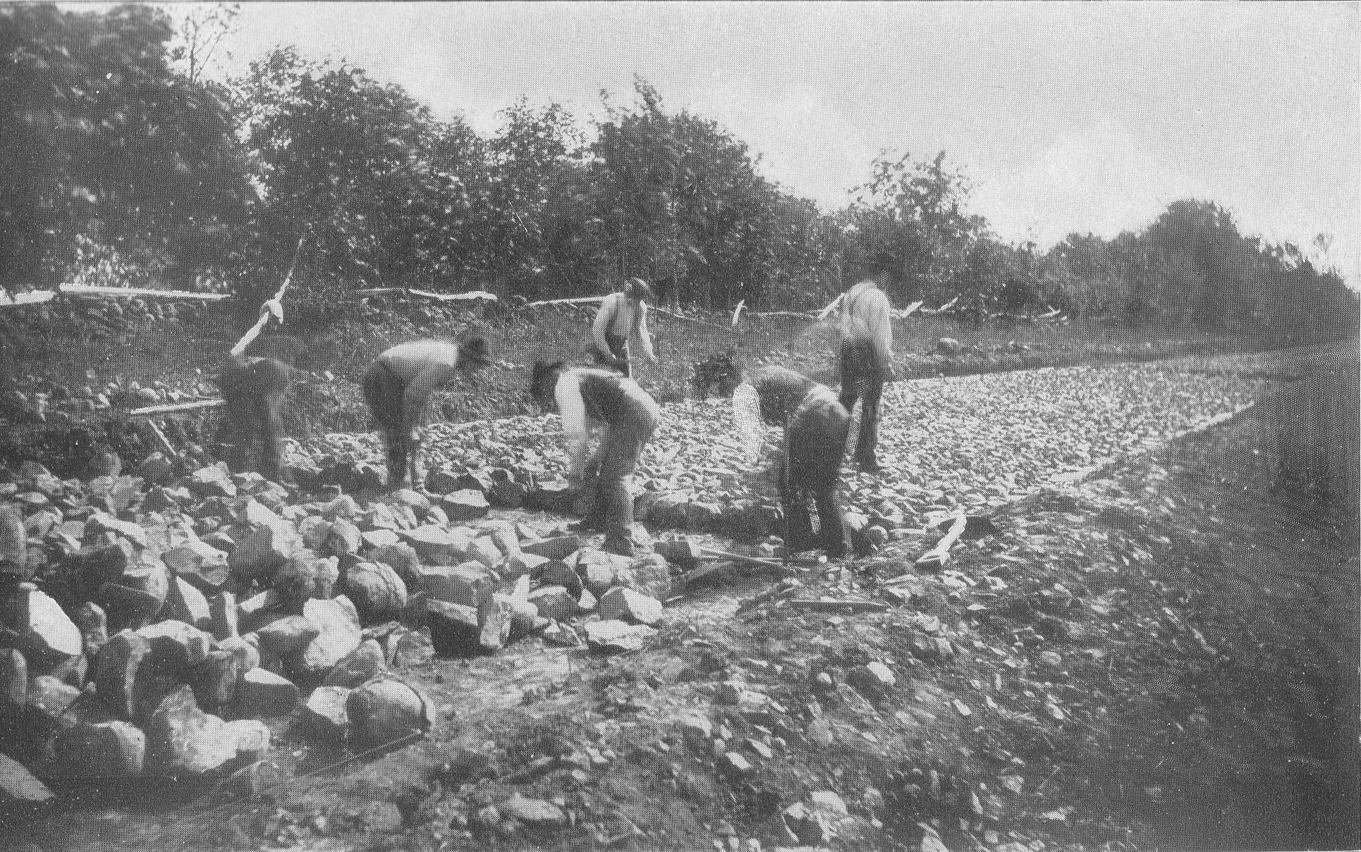
This image is titled "Laying Foundation Stone on Section 4 Confederate Avenue. The location is West Confederate Avenue on Seminary Ridge. The Longstreet Tower has not yet been constructed and would be on the left, or just out of sight on the left. Section 4 of Confederate Avenue went from "Wheatfield Road to Emmitsburg road, 3700 feet." The 1894 commission report states: "From the 13th to 21st of April a majority of those having received specifications for section 4 of the avenue for the purpose of viewing the locality, and were taken over the ground, and on the 21st five bids were haned in, namely Slayor & Boyer, Harrisburg, Pa.; B.B. Gonder, Strausburg, Pa.; Farrell & Bro., Westchester, Pa.; Richard W. Johnson, Wayne, Pa., and P. McManus, Philadelphia, Pa." (pages 14-15 Editors Note: The commission report did not say who got the bid). The 1895 commission report states, "At the date when our report as the Battlefield Commission was made last year the only roadway in process of construction was section 4 of the Confederate avenue, from the Wheatfield road to the Emmitsburg road along Seminary Ridge... All these avenues have been and are being constructed on the Telford system, which was adopted after full consideration and tudy of the subject as promising the best results in solidity and durability. The stone used is syenitic granite and ironstone, very hard and of excellent quality. A foundation pavement is laid of 8-inch wedgelike stones set on edge and well knapped and chinked; on this 4 inches of stone 1 1/2 inches in size; then a slight layer of clay as a binder, and finally a top dressing of 1 or 2 inches of quarter-inch stone screenings; the whole rolled thoroughly with a steam roller weighing 14 tons; side and under drains are placed where needed. The results of the above method and process are roadways smooth and solid and which will last for generations." (page 21) This view was taken facing southeast circa 1894. This image is titled, "A Walk Through Ziegler's Grove Showing Butler's Second United States Battery G." At one time there were five observation towers at Gettysburg National Military Park. Tower #1 was 60 feet tall and was located on Big Round Top. Tower #2 is 75 feet tall and is located on Seminary Ridge. It is known as the Longstreet Tower. Tower #3 used to be 75 feet tall until it was cut down to its current size. It is the Oak Ridge Tower near the Mummasburg Road. Tower #4 is 60 feet tall and is located on Culp's Hill. The first four towers were constructed in 1895. The Ziegler's Grove Tower was constructed in 1896, and must have been known as Tower #5. We do not know if it was 60 feet tall or 75 feet tall. When General Pershing climbed it in July, 1922, he was 61 years old. When then Major General Lejeune climbed it he was 55 years old. In this photograph, Ziegler's Grove had recently been replanted. The Bryan/Brian House is behind the white picket fence. The cannon closest to the path mark the position occupied by John H. Butler's Battery G, 2nd United States Artillery. The monument on the far right of the photograph is to the 108th New York Infantry Regiment. This view was taken facing southwest circa 1896. Annual Reports of the Gettysburg National Military Park Commission to the Secretary of War, 1893-1904. Washington. Government Printing Office, 1905. This image is titled, "016576 Gettysburg From Cemetery Ridge, Gettysburg, PA." It was taken from the top of the Ziegler's Grove Observation Tower looking northward to the town of Gettysburg. In the bottom left of the photograph is an artillery piece marking the location of the 9th Massachusetts Battery on July 3, 1863. At the bottom of the photograph is the top of the monument to the 108th New York Infantry Regiment. Notice the trees recently planted in Ziegler's Grove. The monument most clearly seen in the grove is to the 126th New York Infantry Regiment. Also visible through the grove is the monument to the 90th Pennsylvania Infantry Regiment. Notice the pathway through Ziegler's Grove in the botttom right of the photograph leading away from the tower. The road on the left is Hancock Avenue. Parallel with Hancock Avenue, including the curve is the electric trolley line. This view by the Detroit Publishing Company was taken facing northwest circa 1900-1906. It is part of the Detroit Publishing Company Photograph Collection in the Library of Congress Prints and Photographs Division Washington, D.C. 20540 USA. The reproduction number is LC-D4-16576. The Call number is LC-D4-16576.