150th Anniversary Battle of First Manassas Part 3

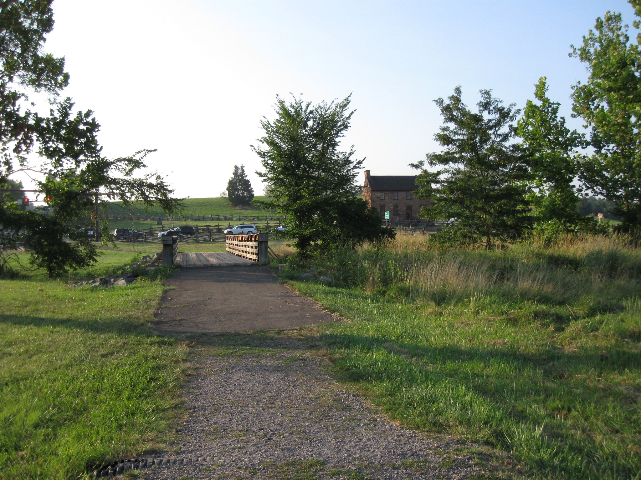
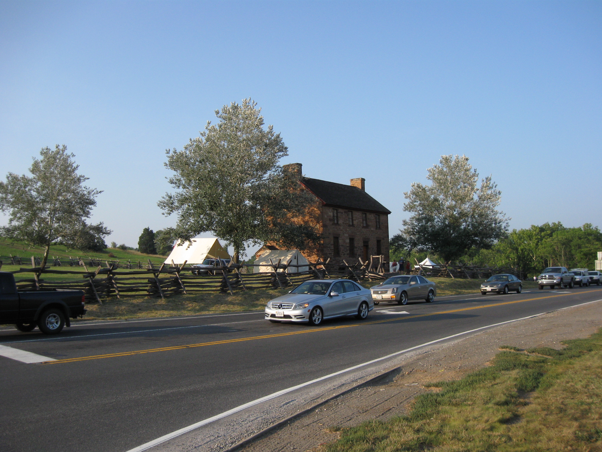
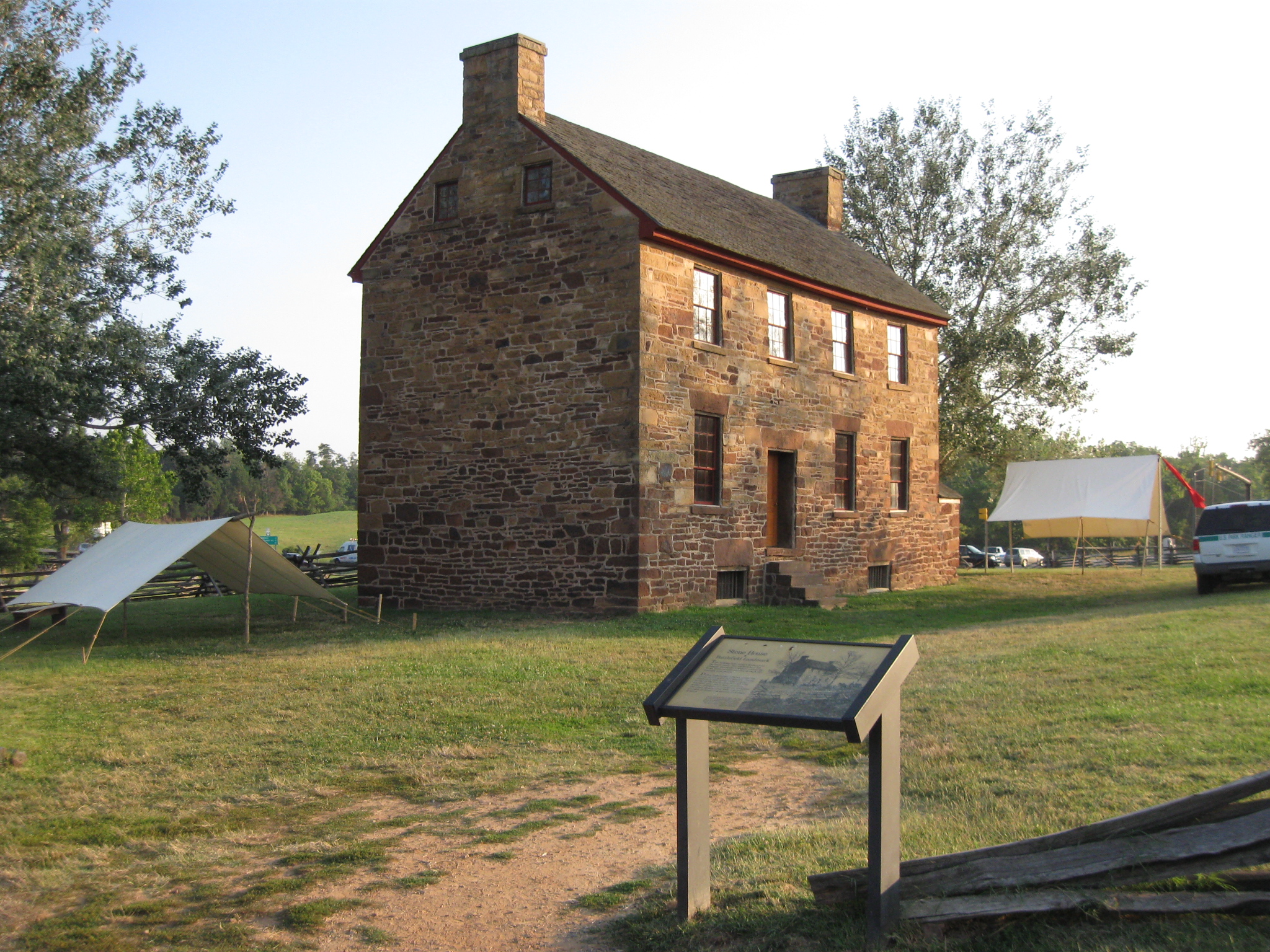
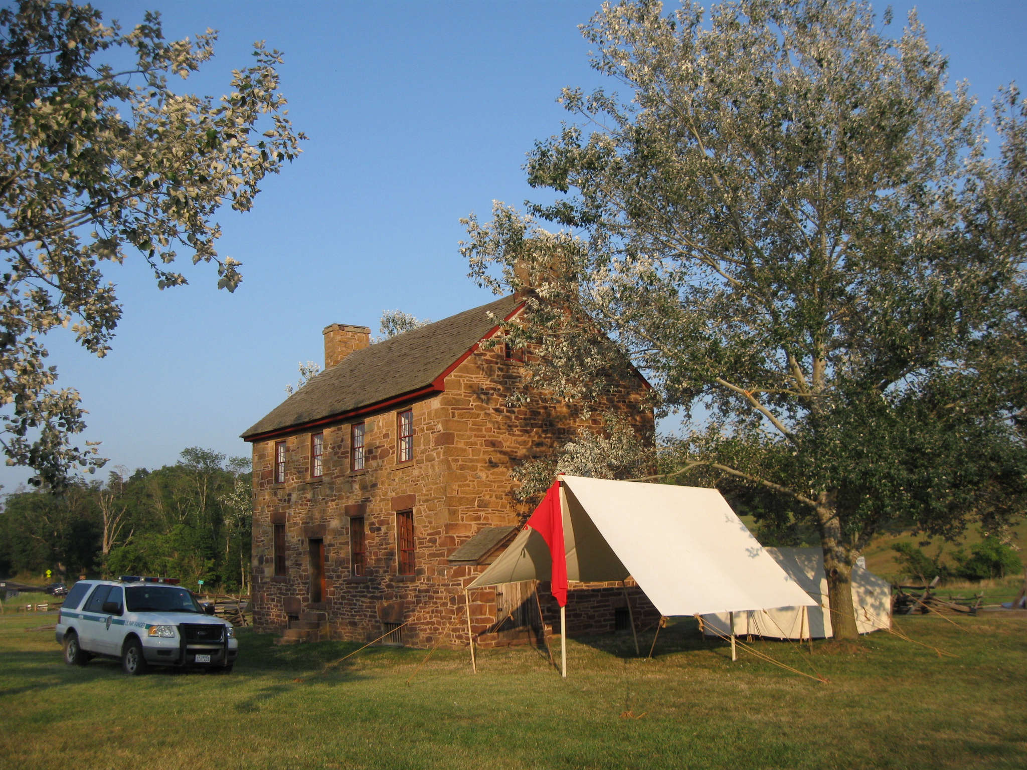
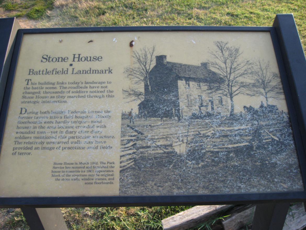
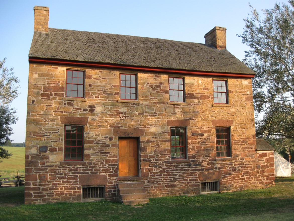
We continue our visit to Manassas National Battlefield to capture scenes in the final hours of daylight on July 21st, the 150th anniversary of the First Battle of Manassas. The Stone House, or Matthews' House, located along the Warrenton Turnpike, was constructed circa 1848. It served as a hospital during the First Battle of Manassas and the Second Battle of Manassas. This view was taken facing northeast at approximately 7:45 PM on Thursday, July 21, 2011.
The Gettysburg Daily decided on Thursday, July 21, 2011 that after finishing their tours at Gettysburg to drive to Manassas. The goal was to stand on the ground on the 150th anniversary of the Battle of First Manassas, to document the scene, and to avoid the crowds.
In the first Manassas 150th Anniversary post we showed the structures that were put in place for the commemoration ceremonies of the 150th Anniversary of the Battle of First Manassas (First Bull Run).
In today's First Manassas 150th Anniversary post we concentrate on the Stone House or Matthews' House. We were fortunate to have been allowed in the house that evening.
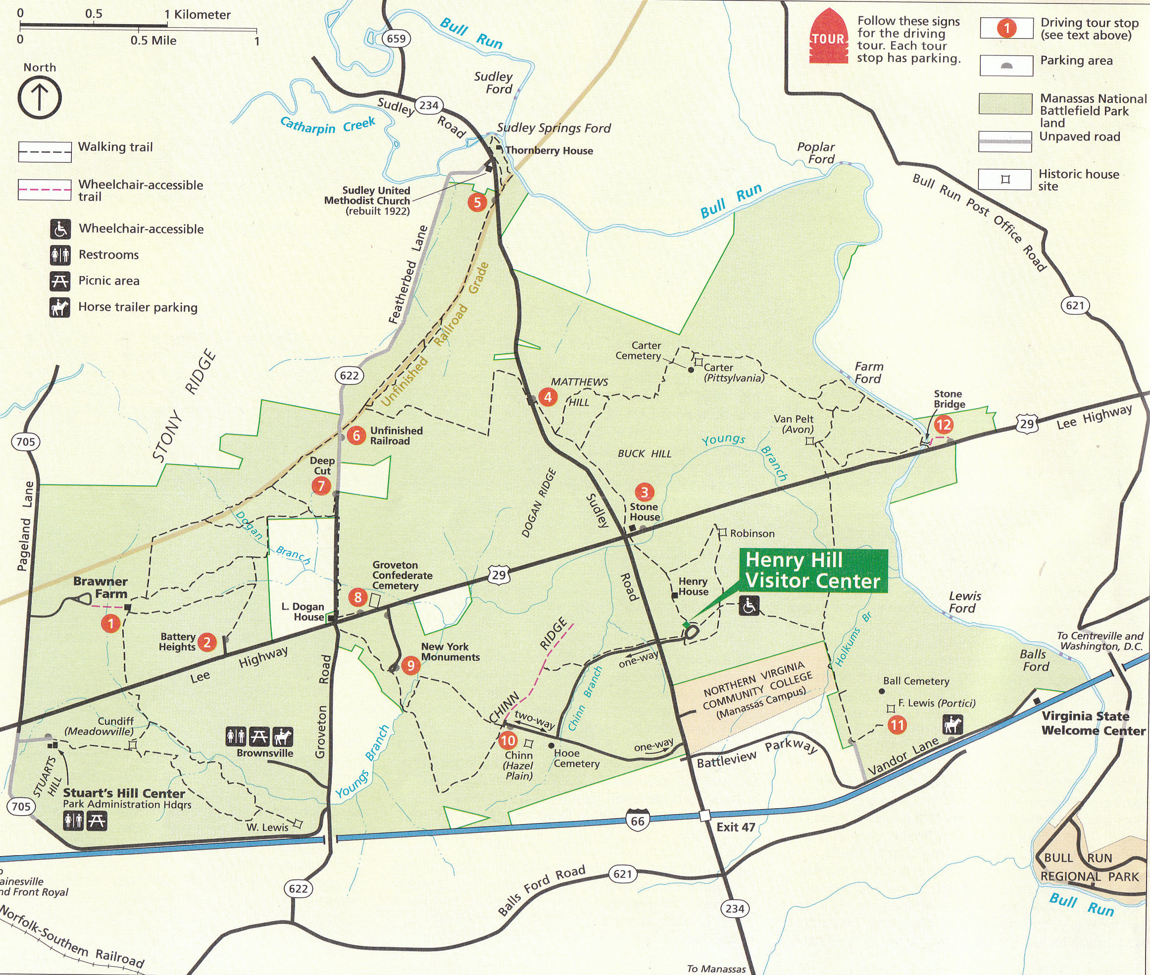
This is the National Park Service Map of Manassas National Battlefield. Most of the map shows areas concerning the Second Battle of Manassas, which was fought from August 28-30, 1862. Today, we are concerned about the First Battle of Manassas, which was fought on July 21, 1861. This final stages of the battle centered around the Henry Hill area, shown in the bottom right of the map. This map was scanned facing north at approximately 11:00 AM on Friday, July 22, 2011.
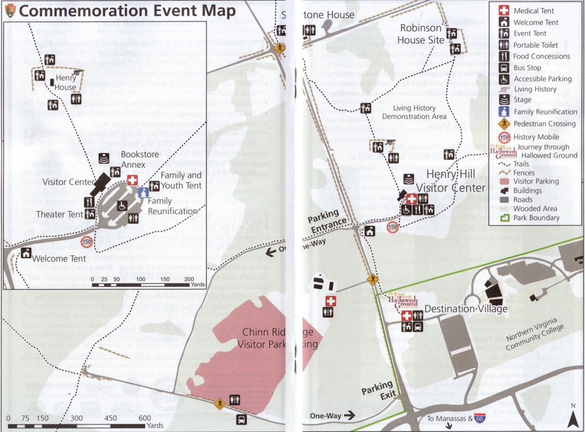
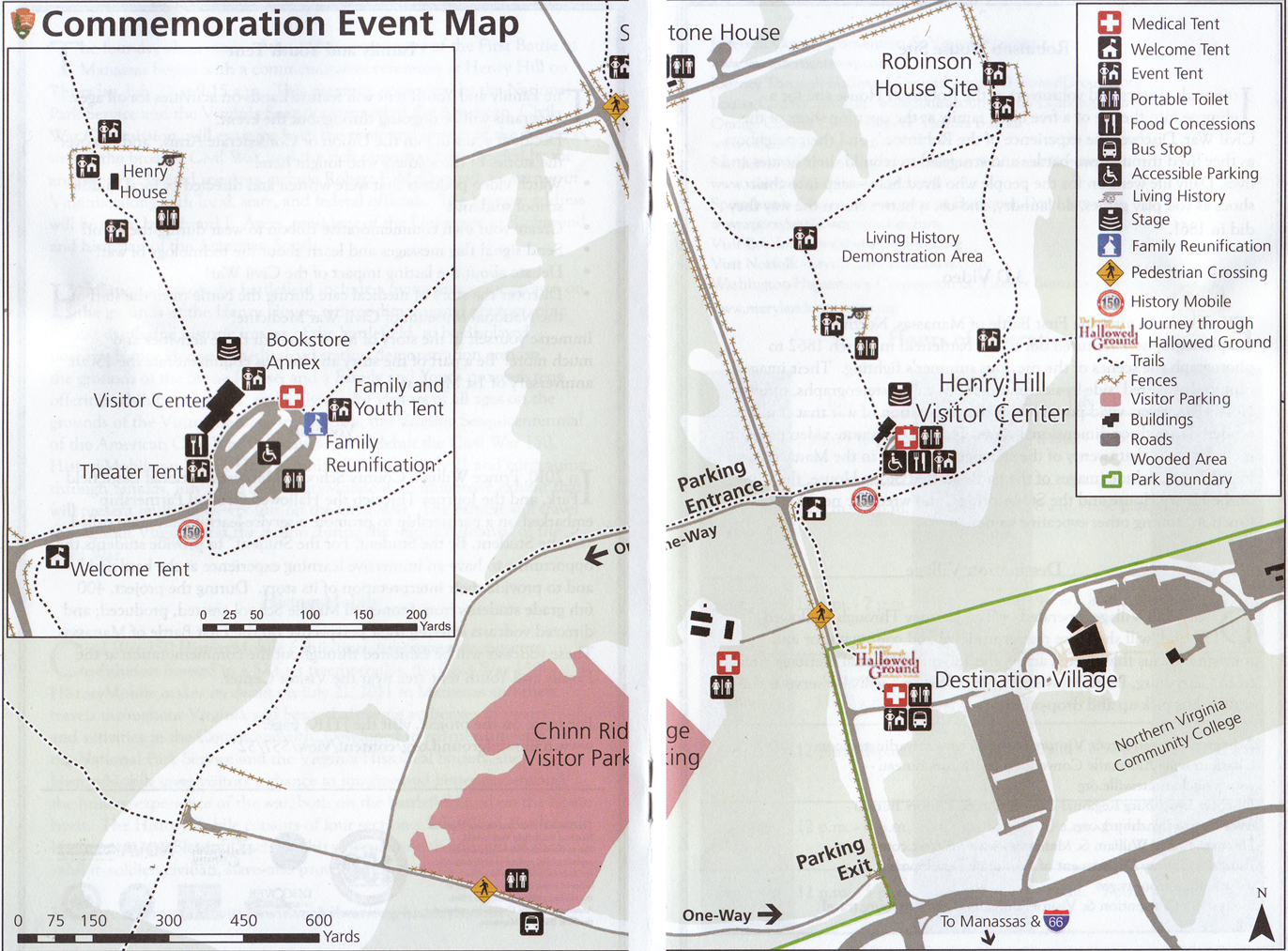
This is the National Park Service Map of the area around Henry Hill for the 150th anniversary period. Large tents, tractor trailers, Coca Cola trucks, Pepsi trucks, food stands, etc... dot the hill of the first major land battle of the American Civil War. So if you had thoughts of going to the battlefield and to be transported back in time 150 years ago, that was difficult. This map was scanned facing north at approximately 11:00 AM on Friday, July 22, 2011.

We are now leaving Henry Hill, and will head towards Matthews' Hill. The Stone House, or Matthews' House, is in the bottom left of this picture. Matthews' Hill is above the house. We will first make our way to a wayside marker to the right of the cedar tree. The tent had lots of free water bottles for visitors. This view was taken facing northwest at approximately 7:45 PM on Thursday, July 21, 2011.

Again we are on Henry Hill. The visitors in front of the wayside were studying the battle. This view was taken facing northwest at approximately 7:45 PM on Thursday, July 21, 2011.

A closer view of this wayside. This view was taken facing northwest at approximately 7:45 PM on Thursday, July 21, 2011.
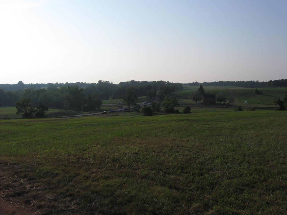
We'll start to move down the hill towards the Stone House. This view was taken facing east at approximately 7:45 PM on Thursday, July 21, 2011.

We'll pause to look back up at the wayside on Henry Hill... This view was taken facing southwest at approximately 7:45 PM on Thursday, July 21, 2011.

... and the structures on Henry Hill. This view was taken facing southeast at approximately 7:45 PM on Thursday, July 21, 2011.

Between Henry Hill and Matthews' Hill is a creek or stream known as Young's Branch. This view was taken facing northwest at approximately 7:45 PM on Thursday, July 21, 2011.

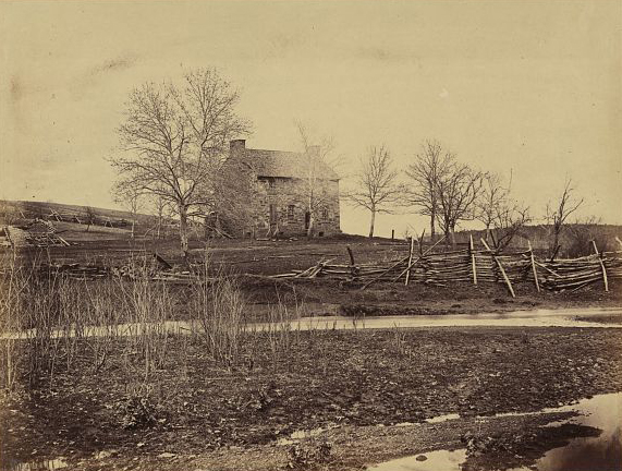
Here's Young's Branch and the Stone House taken between the Battles of Manassas. This view was taken facing north by Alexander Gardner in March, 1862. It is courtesy of the Library of Congress.

Early in the evening the Stone House is still located at a very busy location. The Warrenton Turnpike (US Highway 29) is in the foreground. This view was taken facing northeast at approximately 7:45 PM on Thursday, July 21, 2011.

The Warrenton Turnpike (left to right) intersects the Sudley Road (VA Highway 234) at this location. There is now a pedestrian crossing light to help get us across the Warrenton Turnpike. This view was taken facing northwest at approximately 7:45 PM on Thursday, July 21, 2011.
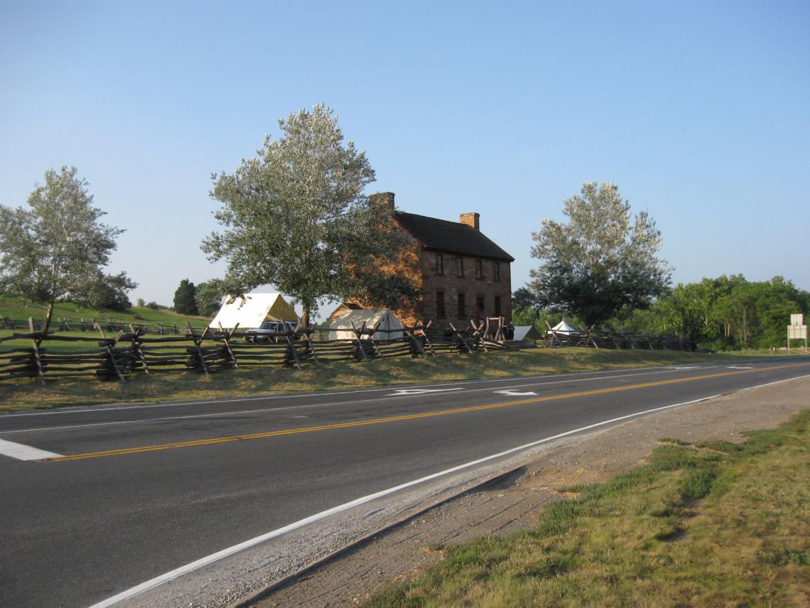
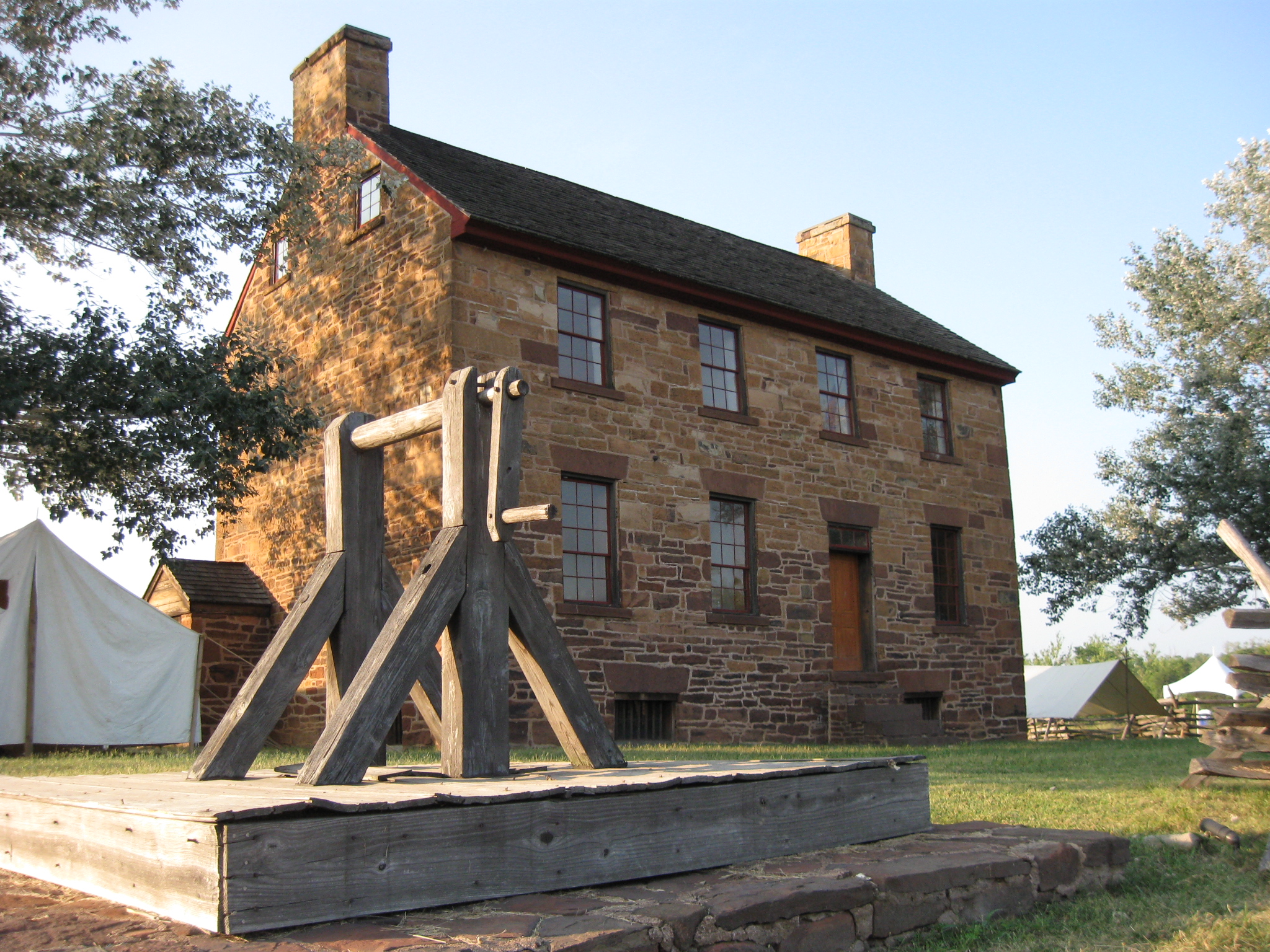
On a rare occasion, no traffic was in front of the Stone House. The Stone House was constructed during the era of turnpikes or toll roads. The Fauquier and Alexandria Turnpike Company was formed in 1808 with the hope of constructing a road that would stretch 28 miles from Fairfax Court House, Virginia to Fauquier Court House (Warrenton), Virginia. The Company hoped the road would help Alexandria, Virginia, compete with Fredericksburg, Virginia, for trade with Fauquier Court House. This view was taken facing northeast at approximately 7:45 PM on Thursday, July 21, 2011.

Six toll gates were located along the route, each about five miles apart, including here at the intersection of the Warrenton Turnpike and the Sudley Road. Once the construction began in 1812, it would take a total of sixteen years (1828) for the road to be completed to Warrenton. This view was taken facing northeast at approximately 7:45 PM on Thursday, July 21, 2011.

It was soon realized that stops along the Warrenton Turnpike would be needed for travelers to receive food, drink, and possibly lodging. So the Stone House was constructed for that purpose in 1848. By 1850, however, when Henry Matthew purchased the property, less travelers were using the turnpike because of the construction and competition of railroads such as at Manassas Junction. Matthew would use the land upon which the house sits for farming. This view was taken facing northeast at approximately 7:45 PM on Thursday, July 21, 2011.

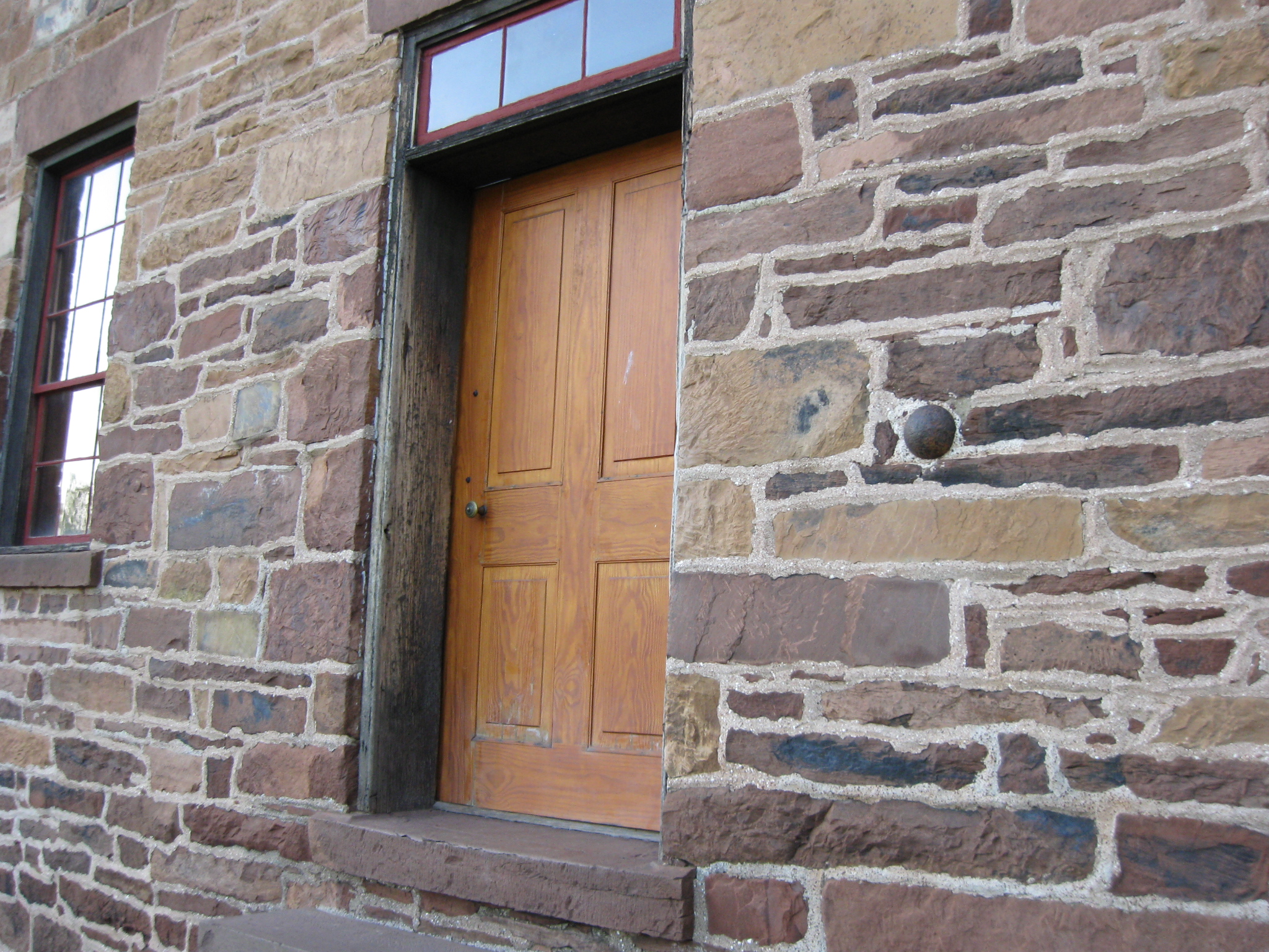
There are a couple of shells/solid shot stuck in the walls of the house. However, they were put in the mortar after the war when the house was used to sell souvenirs. This view was taken facing northeast at approximately 7:45 PM on Thursday, July 21, 2011.

Before one enters the door, one might notice a cannon ball to the right. This view was taken facing northwest at approximately 7:45 PM on Thursday, July 21, 2011.

Again, it was conveniently stuck in the mortar. This view was taken facing northwest at approximately 7:45 PM on Thursday, July 21, 2011.

We feel very fortunate that we were allowed inside the house at this late hour, as long as we didn't bring in our firearm as instructed by the sign to the right of the door. This view was taken facing southeast at approximately 7:45 PM on Thursday, July 21, 2011.

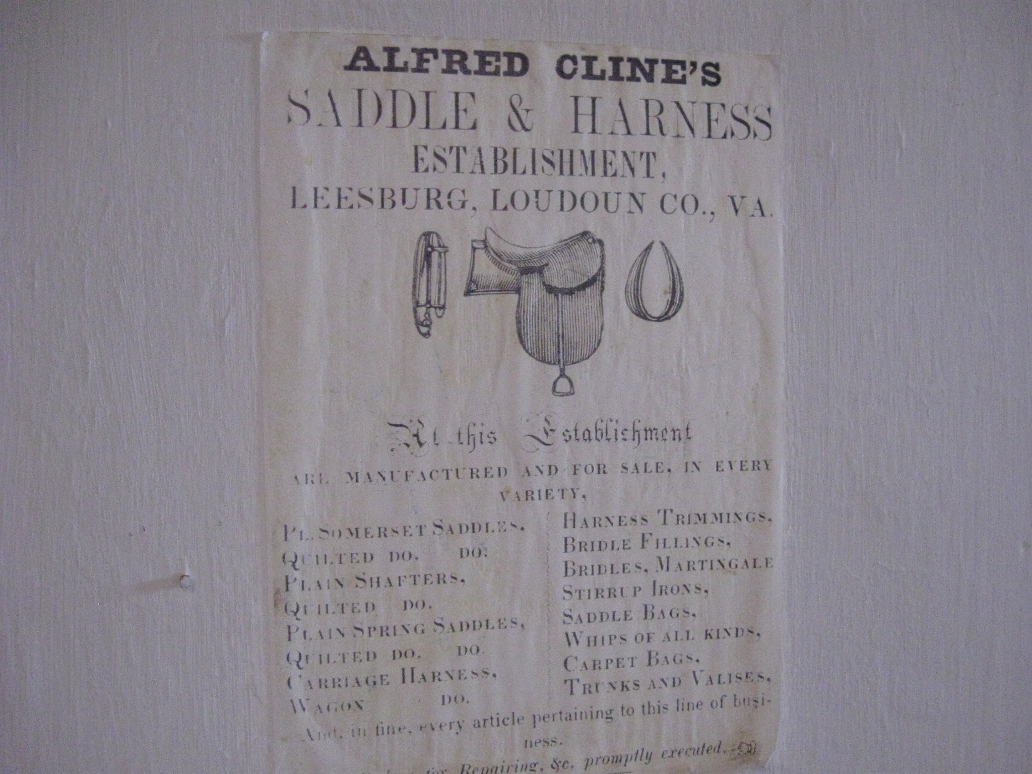
As one enters the house, this was the first room on the left (west). The house is set up as it might have looked to accomodate travelers... This view was taken facing northwest at approximately 7:45 PM on Thursday, July 21, 2011.

...including advertisements on the walls. This view was taken facing southwest at approximately 7:45 PM on Thursday, July 21, 2011.

As one enters the house this was the first room on the right (east). This view was taken facing east at approximately 7:45 PM on Thursday, July 21, 2011.

There is a gate at the bottom of the stairs blocking our access to the second floor. This view was taken facing north at approximately 7:45 PM on Thursday, July 21, 2011.

If we had gone upstairs, we would have seen carvings by two soldiers from the 5th New York Infantry Regiment. They were patients in the hospital established in the house following the Second Battle of Manassas in August, 1862. Private Charles E. Brehm (1841-1909), carved �Brehm Aug 30� into the floorboards. This image is courtesy of the National Park Service.
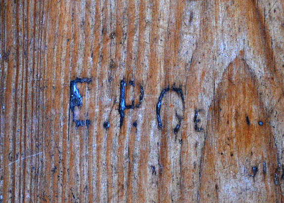
Private Eugene P. Geer (1844-1862) would die of his Manasas wound. Unable to complete his last name, he left the carving �E.P. Ge.� This image is courtesy of the National Park Service.

Here is a view of Henry Hill from the "Tavern Room" of the Stone House. This view was taken facing southeast at approximately 7:45 PM on Thursday, July 21, 2011.
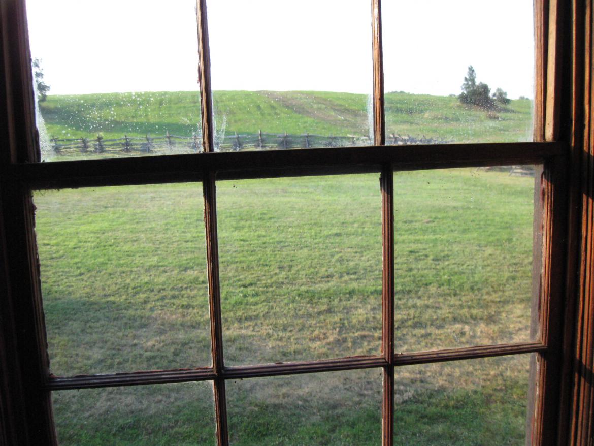
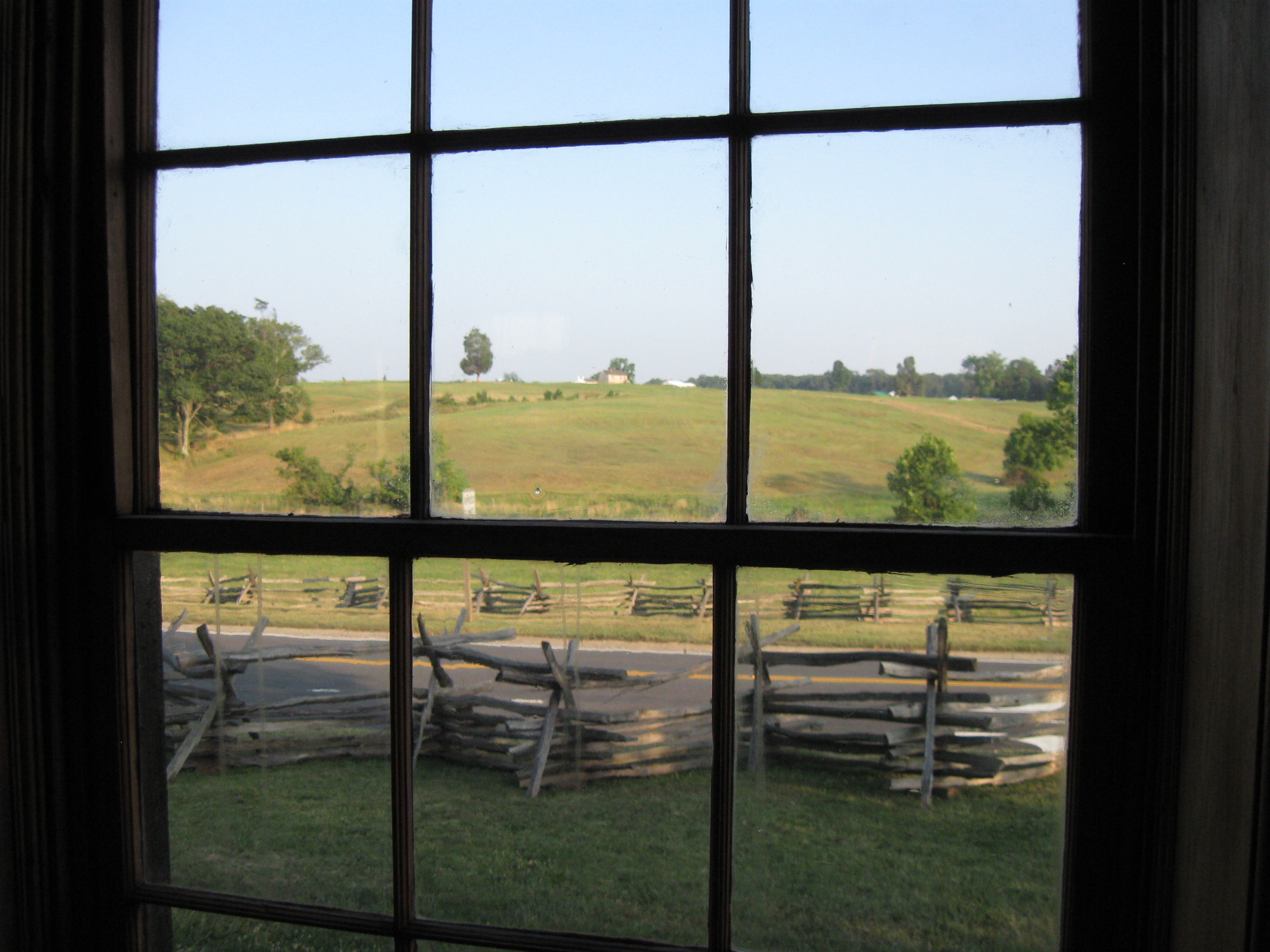
Here is a view of Matthews' Hill from the "Tavern Room" of the Stone House. This view was taken facing northwest at approximately 7:45 PM on Thursday, July 21, 2011.

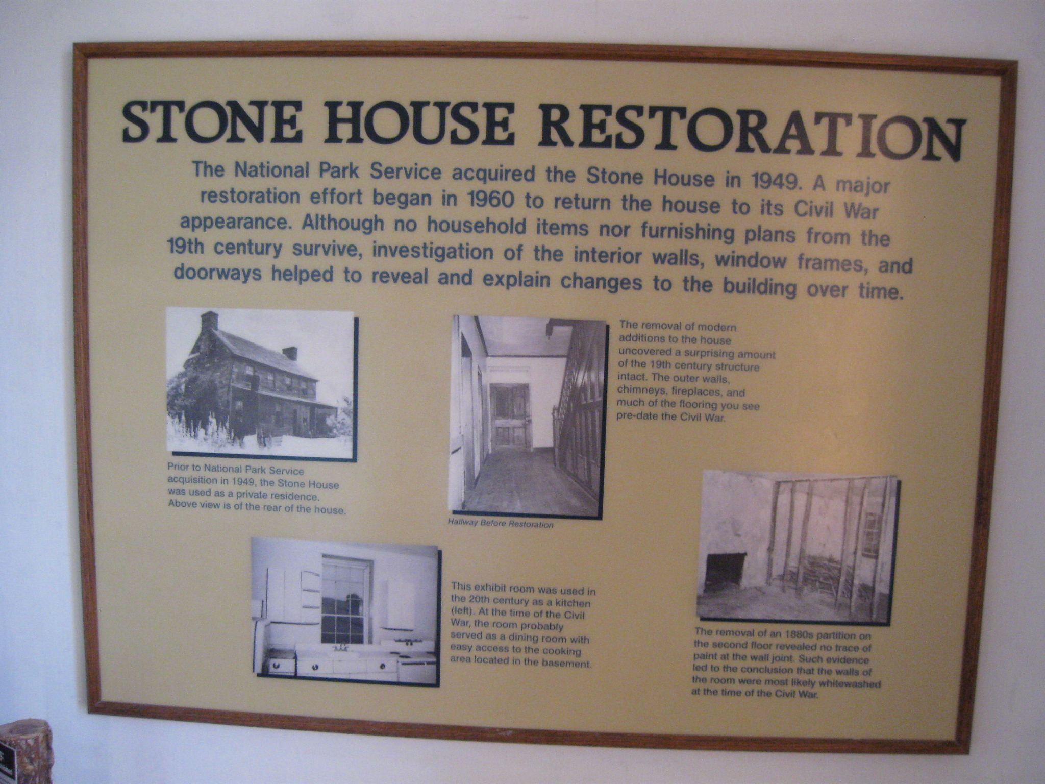
In the northeast room are exhibits showing the history of the Stone House. Here is one on the National Park Service's restoration of the Stone House. This view was taken facing northeast at approximately 7:45 PM on Thursday, July 21, 2011.

An exhibit on the Stone House during the Civil War. This view was taken facing east at approximately 7:45 PM on Thursday, July 21, 2011.

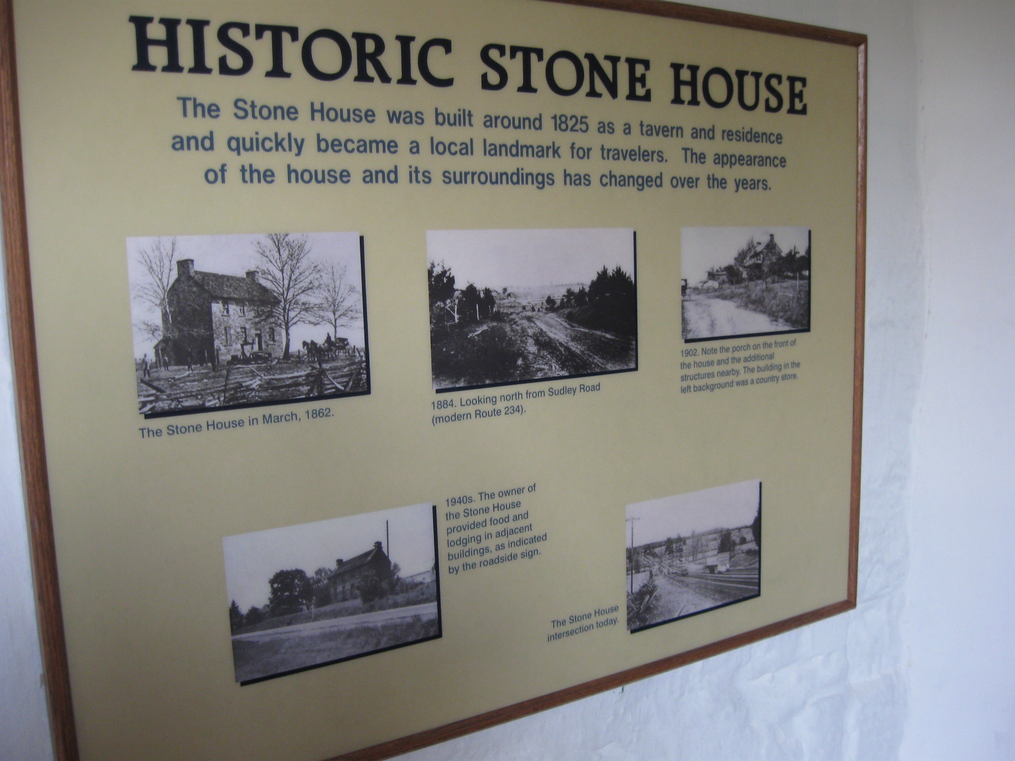
The Stone House at various stages of its existence. This view was taken facing northeast at approximately 7:45 PM on Thursday, July 21, 2011.

The basement of the Stone House has a stone floor. It is believed that this was the main kitchen for the tavern. This view was taken facing south at approximately 7:45 PM on Thursday, July 21, 2011.

The northeast side of the Stone House. This view was taken facing southwest at approximately 7:45 PM on Thursday, July 21, 2011.
A closeup of the wayside exhibit. This view was taken facing southwest at approximately 7:45 PM on Thursday, July 21, 2011.
The back of the Stone House. This view was taken facing southwest at approximately 7:45 PM on Thursday, July 21, 2011.

The northwest side of the Stone House. The ranger vehicle is here because they were having some problems with the alarm system at the Stone House that evening. This view was taken facing southeast at approximately 7:45 PM on Thursday, July 21, 2011.

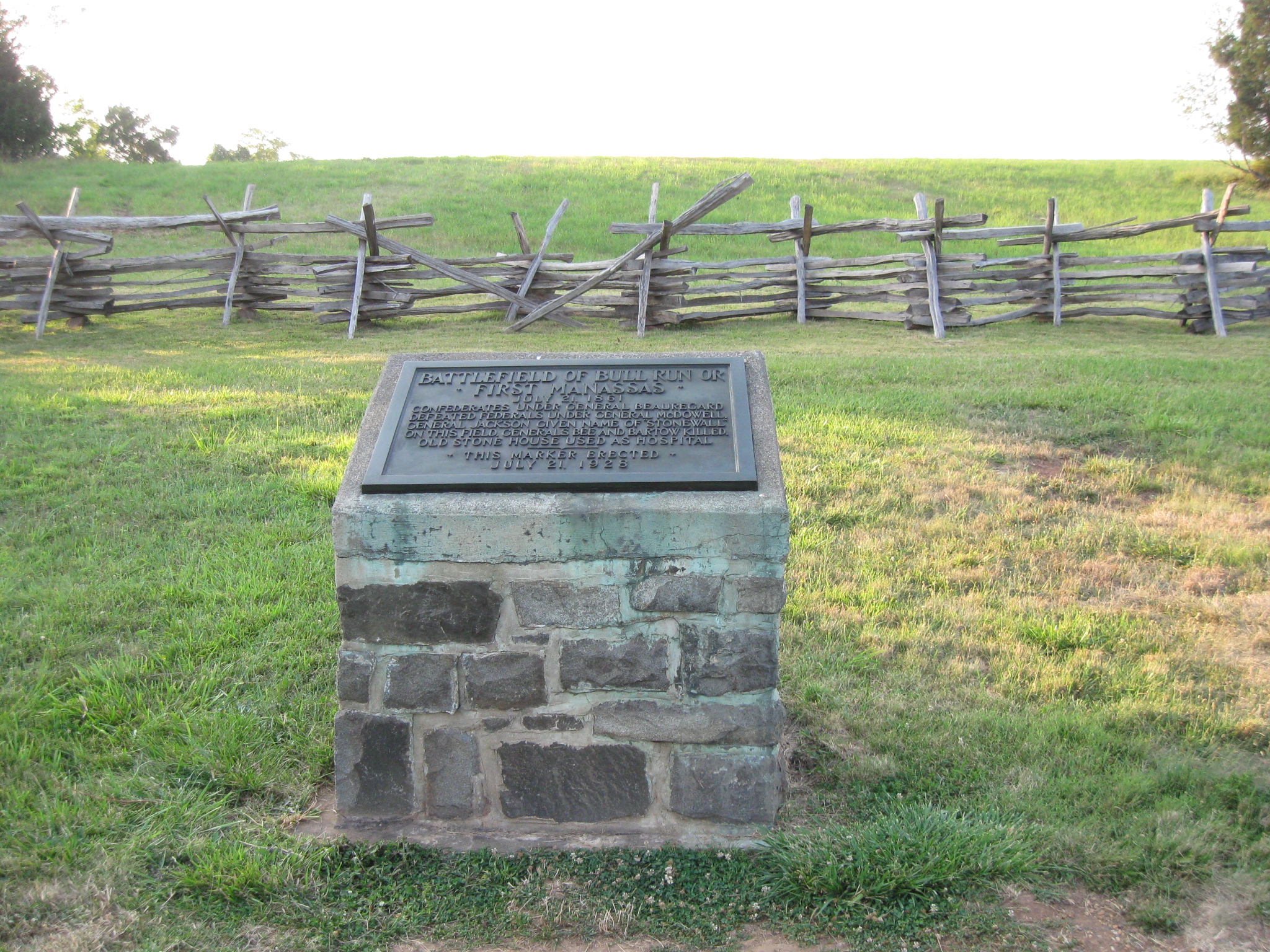
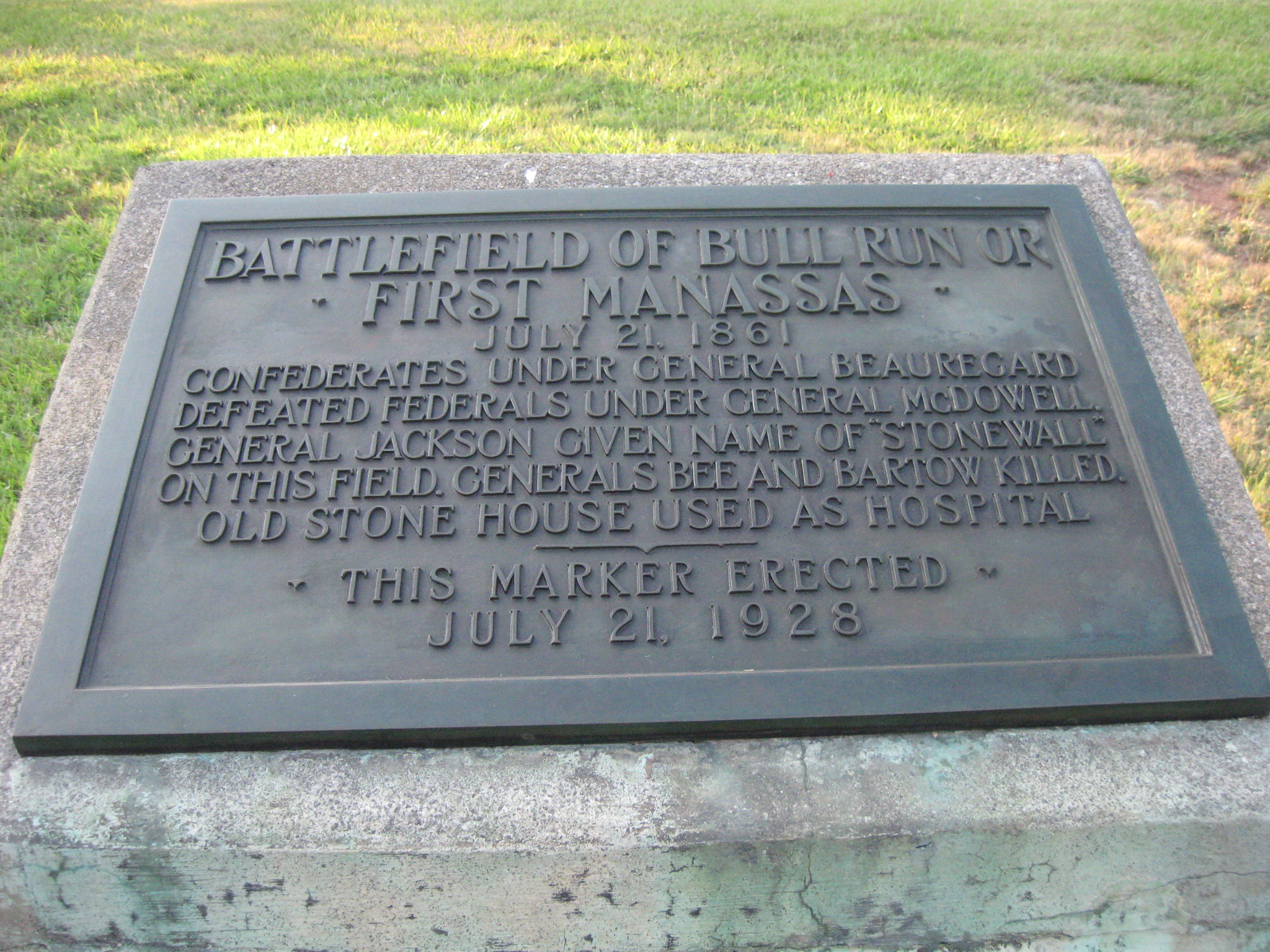
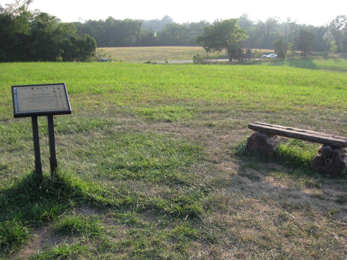
There is a marker in the backyard of the Stone House. This view was taken facing north at approximately 7:45 PM on Thursday, July 21, 2011.

It is located northwest of the Stone House. This view was taken facing southeast at approximately 7:45 PM on Thursday, July 21, 2011.

So although we were there for the 150th Anniversary of the Battle of First Manassas, we ended up reading this marker on the 83rd Anniversary of when it was erected. This view was taken facing north at approximately 7:45 PM on Thursday, July 21, 2011.

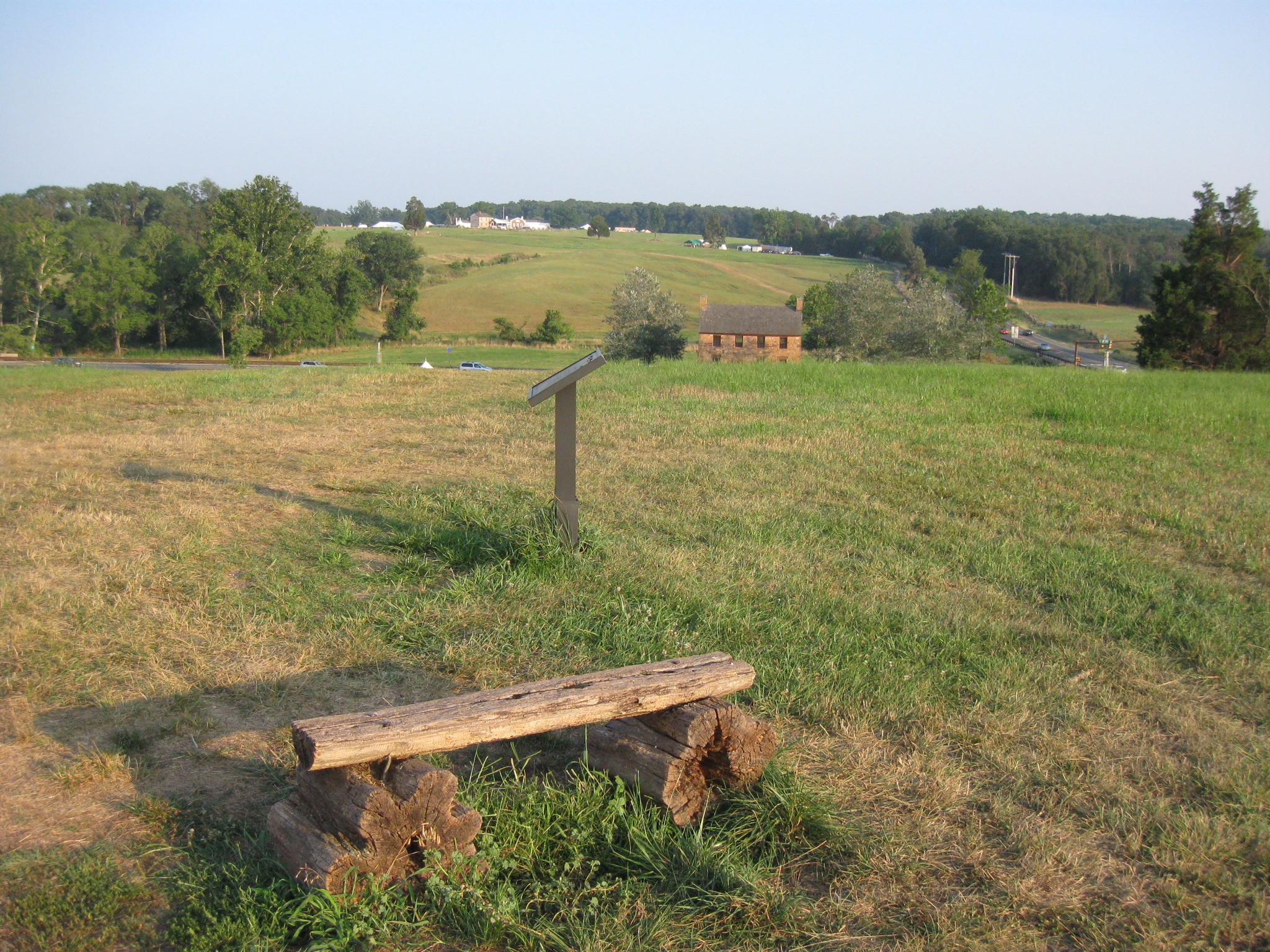
We're walking up Matthews' Hill to see if we can find any markers related to the Battle of First Manassas. The Stone House is in the right background. The Henry House is on Henry Hill in the left background. This view was taken facing southeast at approximately 7:45 PM on Thursday, July 21, 2011.
At the top of Matthews' Hill, the only marker/wayside was for the Second Battle of Manassas. The Sudley Road is in the background. This view was taken facing northwest at approximately 7:45 PM on Thursday, July 21, 2011.
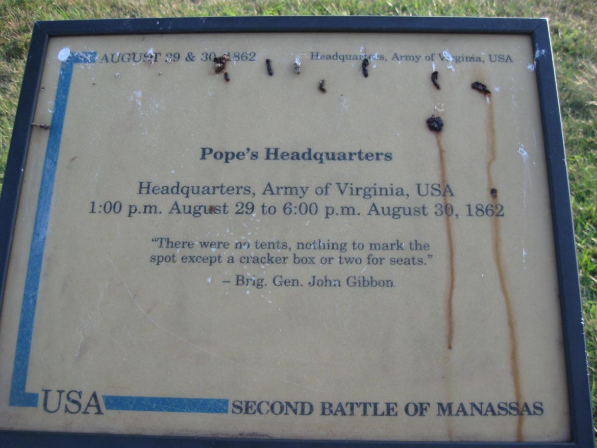
The National Park Service has probably not cleaned up this wayside in honor of Brigadier General Samuel Sturgis' famous comment about the Union commander at the Battle of Second Manassas: "I don't care for John Pope one pinch of owl dung." This view was taken facing west at approximately 7:45 PM on Thursday, July 21, 2011.

During the Battle of First Manassas, United States soldiers outflanked the Confederates on Matthews' Hill (where we are standing) and pushed them back towards Henry Hill in the background. This view was taken facing southeast at approximately 7:45 PM on Thursday, July 21, 2011.
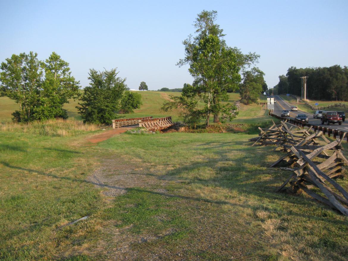
We will follow that action as we make our way back across Young's Branch and up Henry Hill. This view was taken facing southeast at approximately 7:45 PM on Thursday, July 21, 2011.
We feel the best book on the Battle of First Manassas is John Hennessy's book,
First Battle of Manassas: An End to Innocence.
It is part of the Virginia Civil War Battles and Leaders Series by H.E. Howard.
This image was scanned facing north at approximately 7:40 PM on Sunday, August 7, 2011.