Licensed Battlefield Guide Bobby Housch: East Cemetery Hill Part 3

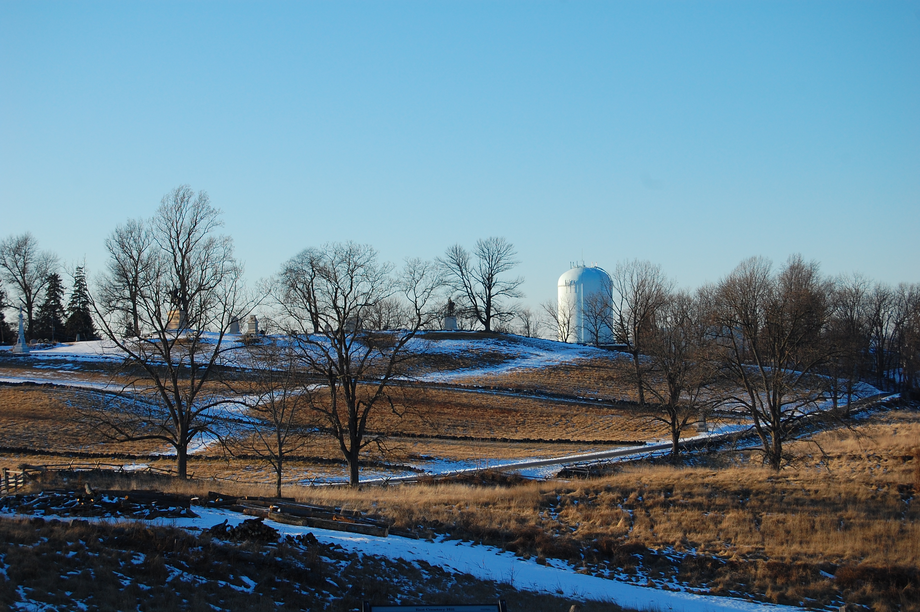
East Cemetery Hill is the only part of Cemetery Hill attacked by a significant amount of Confederate infantry. The Confederates briefly broke through parts of the Union lines on the hill. One of the reasons is that the defenders did not take precautions to defend the hill's convex shaped slopes. This view was taken facing northwest at approximately 3:45 PM on Saturday, January 22, 2011.
Gettysburg Licensed Battlefield Guide Bobby Housch is a history teacher in a local public school district, and the editor of this website, the Gettysburg Daily. He grew up studying the "western theater" of the American Civil War. He also has more than a few relatives in the American Civil War, most of them from Georgia and Alabama.
In the first East Cemetery Hill post, Gettysburg Licensed Battlefield Guide Bobby Housch introduced himself, showed Cemetery Hill in relation to other pieces of "high ground," and showed roads and other landmarks on East Cemetery Hill.
In the second East Cemetery Hill post, Gettysburg Licensed Battlefield Guide Bobby Housch discussed the positions of some of the first artillery and infantry units on East Cemetery Hill, and the location of the Cemetery Hill signal stations.
In today's East Cemetery Hill post, Gettysburg Licensed Battlefield Guide Bobby Housch discusses slope, slope, slope and slope. Cemetery Hill has different slopes, some of which are more easily defended than others.
To contact Licensed Battlefield Guide Bobby Housch, please click here to reveal his email address.

This map shows the location of the videos for the East Cemetery Hill posts. Video #1 was taken on East Cemetery Hill, north of the Evergreen Cemetery Gatehouse. Video #2 was taken in Evergreen Cemetery on the south slope of Cemetery Hill. Video #3 was taken on East Cemetery Hill covering an area beginning at Rickett's Battery to the stone wall where the tulip poplar tree was located during the battle. Video #4 was taken near the position of Wiedrich's Battery. Video #5A was taken near Howard's Headquarters Marker. Video#5B was taken near the Lincoln Speech Memorial in the National Cemetery. Video #6 was taken near the location of the Hancock Equestrian Statue. Video #7 was taken in the Soldiers National Cemetery on the driveway/avenue separating the Civil War and post-Civil War sections. Video #8 was taken on McKnight's Hill/Stevens' Knoll. Video #9 was taken near the Gettysburg High School football field and then walking to the north. This map was created facing north at approximately 6:00 AM on Sunday, January 23, 2011.

Gettysburg Licensed Battlefield Guide Bobby Housch is standing in the Soldiers National Cemetery. The defenders of this western part of Cemetery Hill for the most part defended a "gentle" slope. Defenders on "gentle" slopes could see and command the ground with their weapons from the top of the hill (near the Soldiers National Monument) to the bottom of the hill at the Emmitsburg Road/Steinwehr Avenue (out of sight on the right). This view was taken facing south at approximately 3:45 PM on Saturday, January 22, 2011.
1In Video #7 Gettysburg Licensed Battlefield Guide Bobby Housch introduces us to the categories of slopes that the United States Military uses today. He explains that this western part of Cemetery Hill was more or less a "gentle" slope. Even though he says in the video that this was an "easy" slope to defend he meant that there were less difficulties defending this slope than other slopes. This view was taken facing south to northwest at approximately 3:45 PM on Saturday, January 22, 2011.

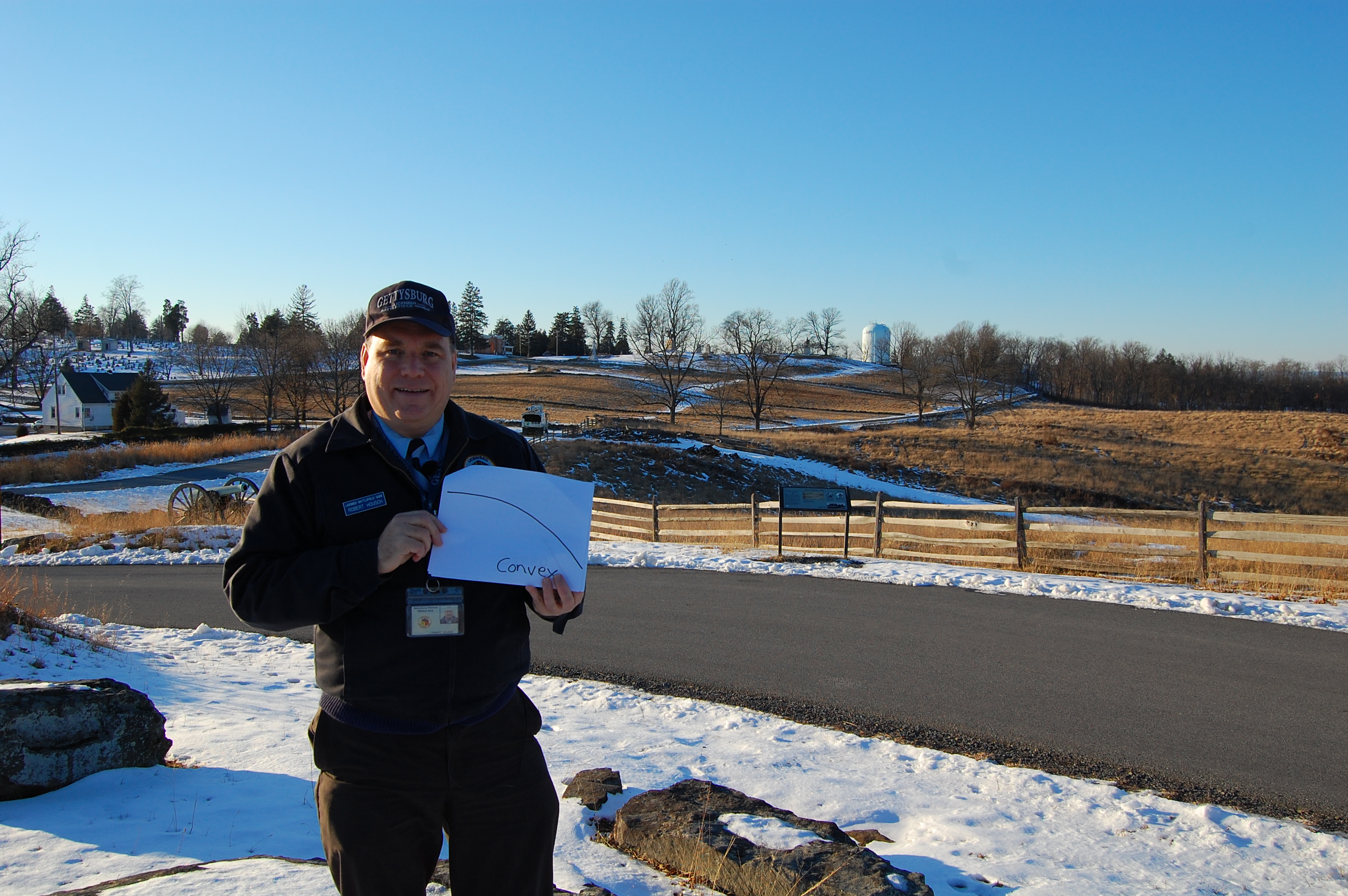
Licensed Battlefield Guide Bobby Housch is standing on McKnight's Hill/Stevens' Knoll. He is holding up a drawing which "in general" shows a convex slope. On convex slopes, the ground that one is defending "bows out" towards the enemy before it goes down hill. This is the type of slope United States soldiers on East Cemetery Hill were defending. Notice in the background how the ground on East Cemetery Hill near the Hancock equestrian monument "bows out" toward the Howard equestrian monument before it goes down hill. This means that defenders at the top of the hill have a difficult time seeing attackers at the bottom of the hill. This view was taken facing northwest at approximately 3:45 PM on Saturday, January 22, 2011.
2In Video #8 Licensed Battlefield Guide Bobby Housch is standing on McKnight's Hill/Stevens' Knoll. He points out that East Cemetery Hill has features of a convex slope which will present challenges to defenders of the hill. This video was taken starting facing northwest at approximately 3:45 PM on Saturday, January 22, 2011.
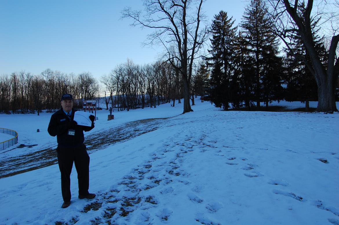
Bobby Housch is standing on the northeast slope of East Cemetery Hill. Part of the Gettysburg High school football stadium is on the left. In the background where the sun is setting is the more or less convex slope of East Cemetery Hill projecting to the east. The Hancock equestrian monument is barely visible through the trees. East Cemetery Hill also has a more or less convex slope extending to the north or going from left to right in the background, and towards the camera. This view was taken facing south at approximately 4:45 PM on Friday, May 16, 2008.
3In Video #9 Bobby Housch is on the northeast slope of East Cemetery Hill near the Gettysburg High School football stadium. He walks towards the north on or near the old Brickyard Lane, towards the town of Gettysburg. Along the way he shows how the north slope projects 100 yards farther towards the Confederates than any other part of the hill, and forms a salient. This video was taken from the south to the northwest to the west at approximately 3:45 PM on Saturday, January 22, 2011.
To see other posts by Gettysburg Licensed Battlefield Guides, click here.