Country Club Property Formerly Occupied by Katalysine Springs Hotel

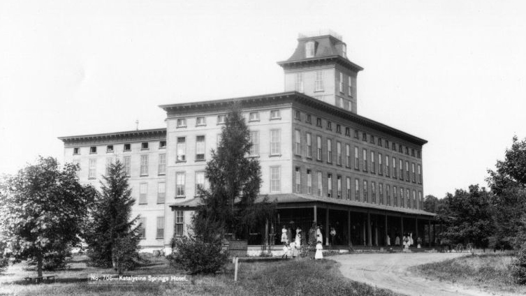
The Katalysine Springs Hotel, also known as the Springs Hotel, was in existence from 1869 until it burned on December 17, 1917. This view by William Tipton was taken facing west circa the 1890s, and was part of his "Views Around Gettysburg" series.
On Friday, March 25, 2011, the Conservation Fund and the Civil War Trust turned over 94 or 95 acres (depending on the source) of land to the National Park Service. This land was once the Gettysburg Country Club which was in existence from 1948-2008. The purchase price was approximately $1.6 million. The land had also been the site of the Katalysine Springs Hotel.

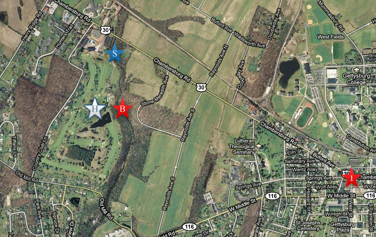
This map shows the location of the hotel and the springs. The white star with the "H" is the approximately location of the hotel (according to the 1904 Cope Map). The blue star with the "S" is the approximately location of the springs along Willoughby Run. The red star with the "1" shows where Springs Avenue forms a juction with the Chambersburg Pike. The red star with the "B" shows where the bridge built for the trolley crossed Willoughby Run. The Country Club property is bordered to the west with private property along the east side of Country Club Lane. Old Mill Road borders it to the south. Willoughby Run borders it to the east. The the north, the property line is trickier. Its not the Chambersburg Pike. Its the Country Club buildings that are south of the Chambersburg Pike. This map was created facing north at approximately 9:00 PM on Saturday, March 26, 2011.
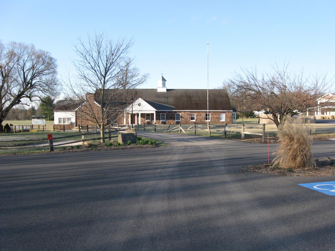
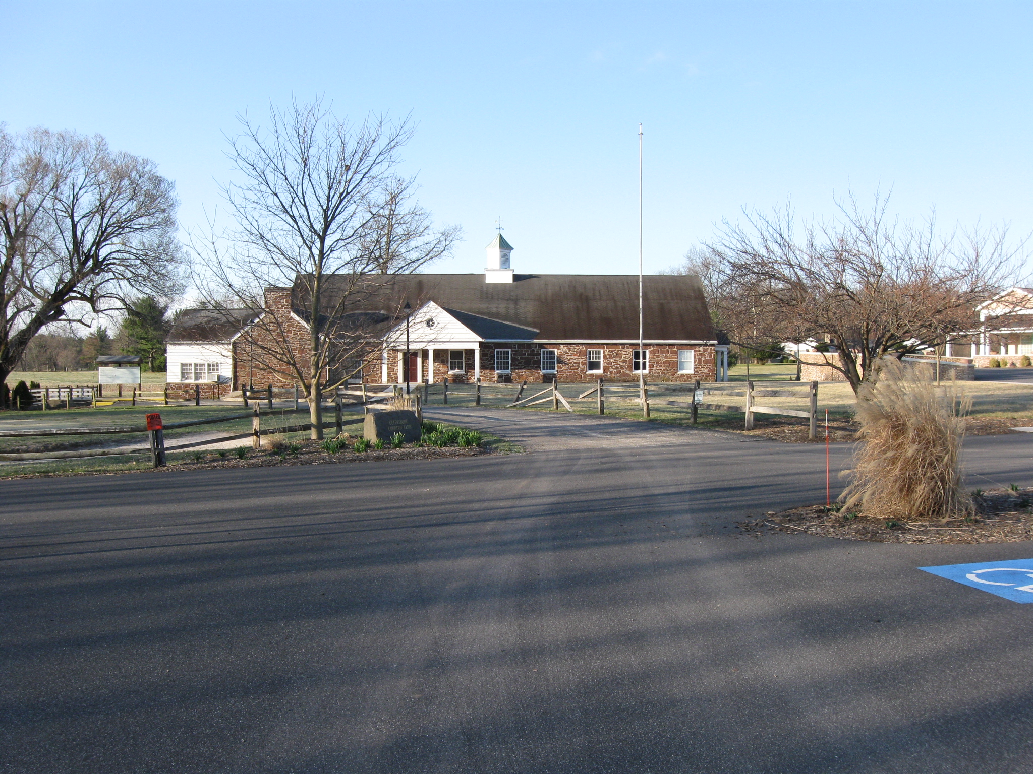
Now before one accesses this land, a couple of things should probably be made clear. Even though the National Park Service was donated the land, they were not donated an easy access to the property. So if you think you can enter from the Country Club parking lot, you can't. The developer kept the Country Club building (shown here), another building off to the right and the swimming pool and tennis courts. So this is private property. You will be trespassing if you try to enter the National Park Service land from this area. This view was taken facing southwest at approximately 8:30 AM on Saturday, March 26, 2011.

So the best way to access the property is from the National Park Service land on McPherson's Ridge. There are a couple of ways to go in, of course. This view was taken facing west at approximately 5:15 PM on Saturday, March 26, 2011.
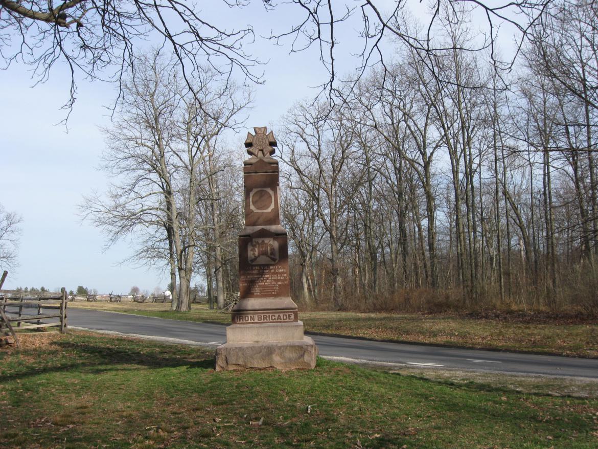
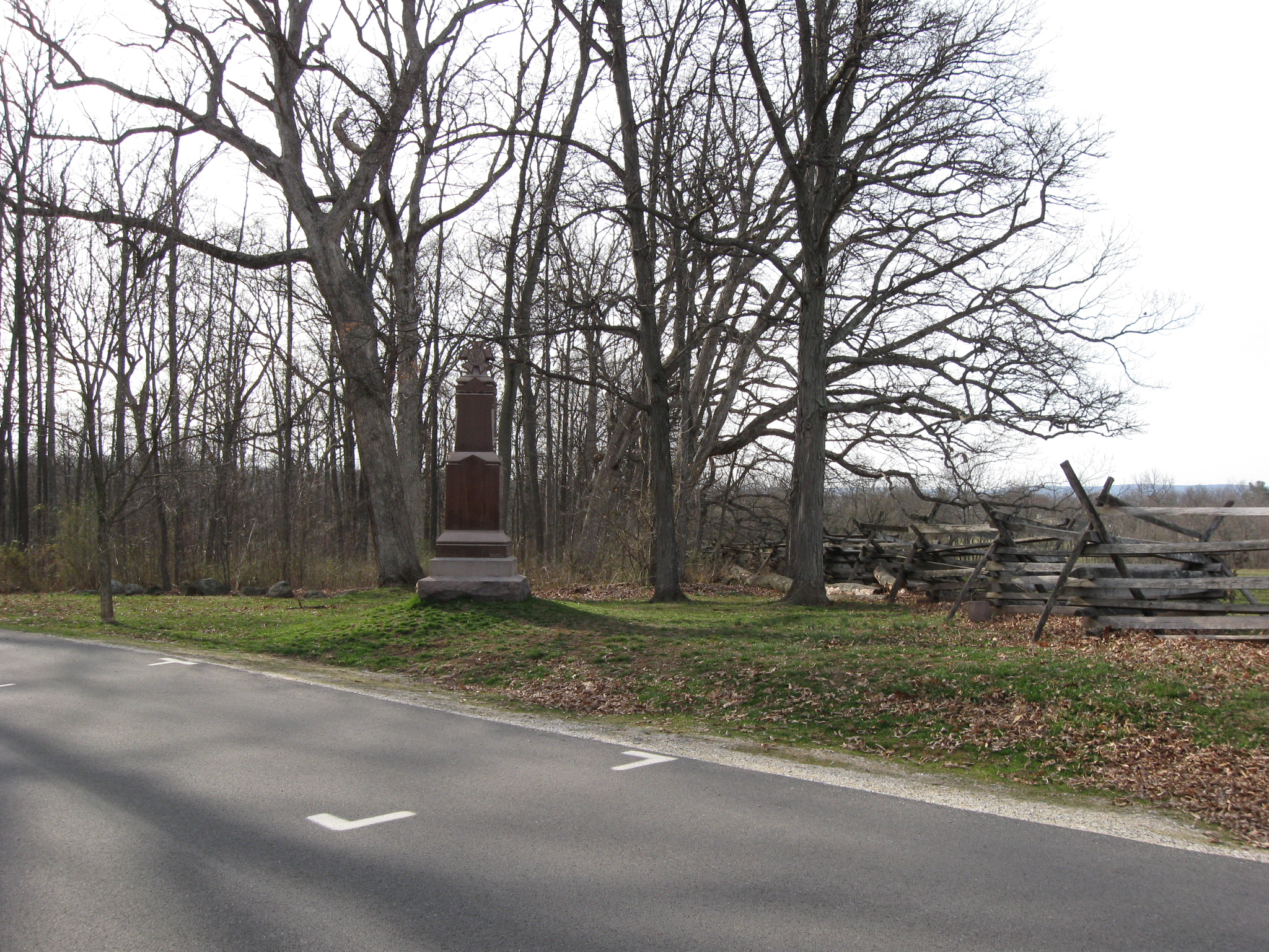
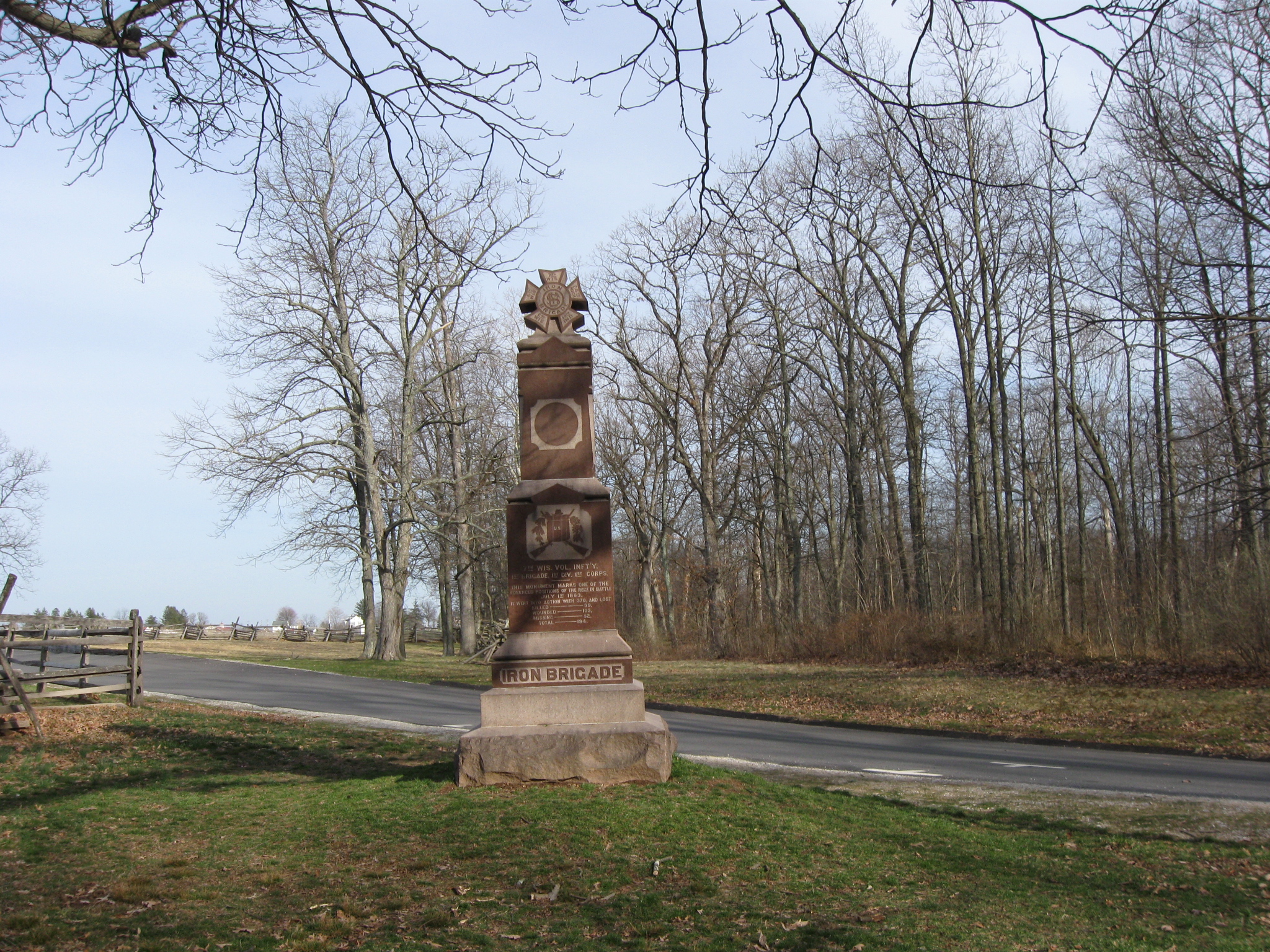
This time we'll go in by the monument to the 7th Wisconsin Infantry Regiment near Stone Avenue. This view was taken facing east at approximately 5:15 PM on Saturday, March 26.
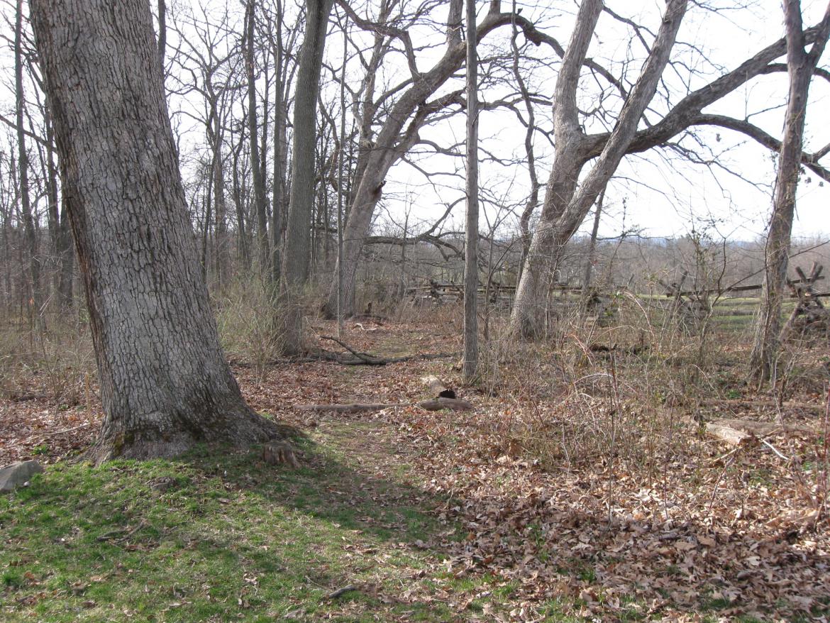
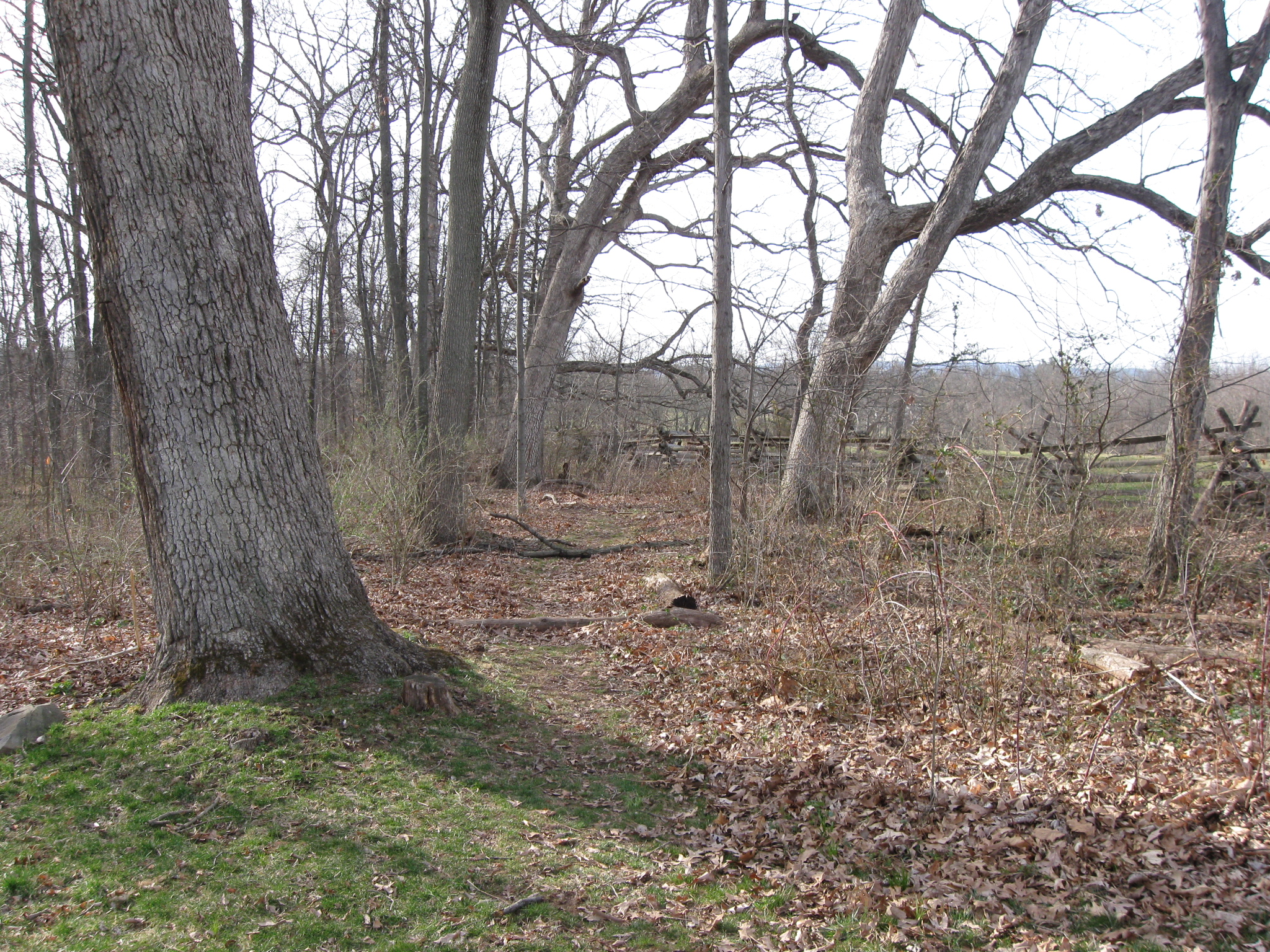
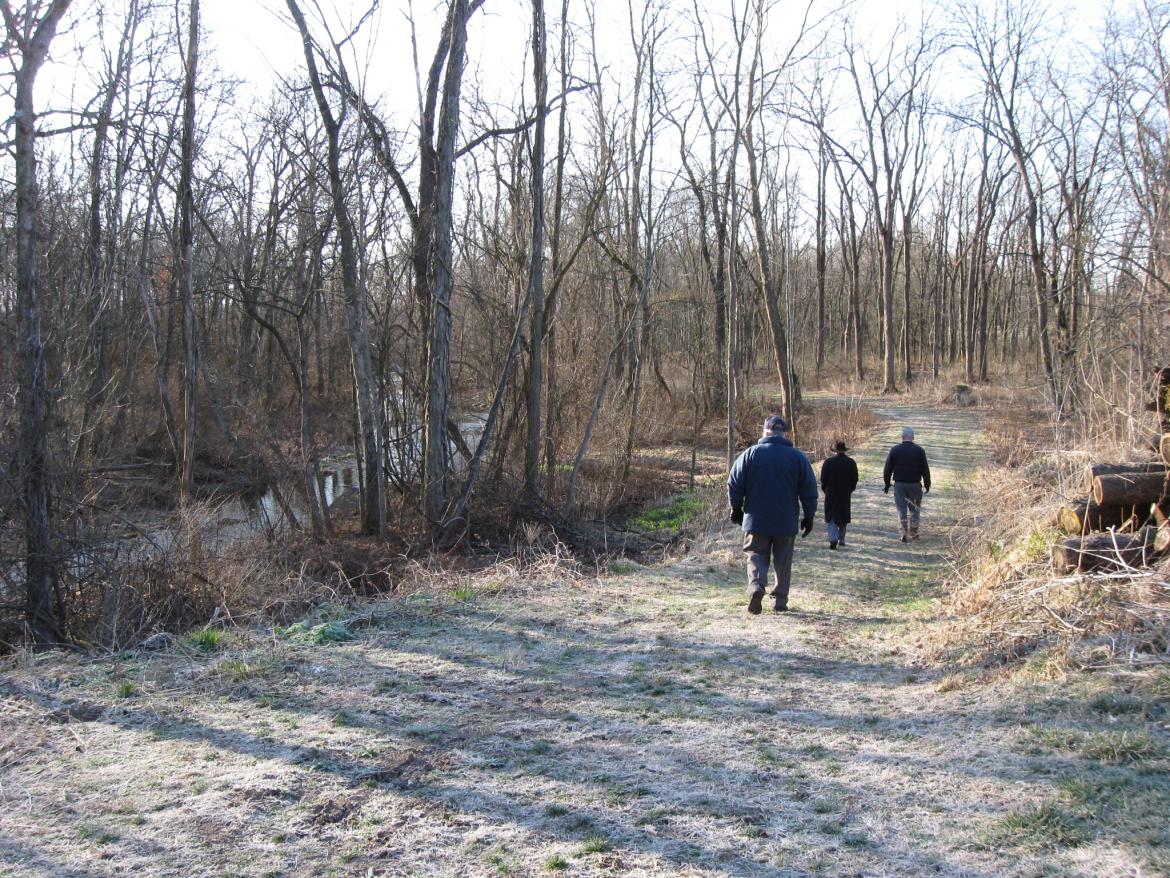
We'll take this trail through the woods that leads down to Willoughby Run. This view was taken facing west at approximately 5:15 PM on Saturday, March 26, 2011.
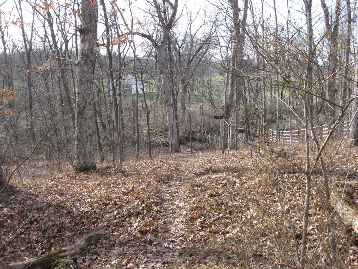
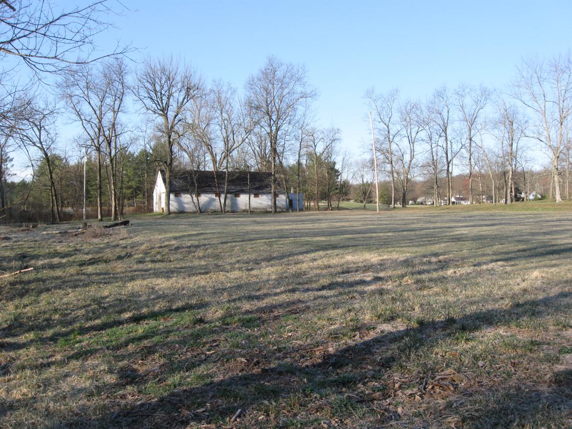
We're now approaching Willoughby Run. The white building is on the newly acquired Country Club land. This view was taken facing west at approximately 5:15 PM on Saturday, March 26.

We are passing the quarry, here filled with water. This is in the area where Brigadier General James Archer was captured on July 1, 1863, or he was captured on the other side of Willoughby Run on the newly acquired land. This view was taken facing northeast at approximately 5:15 PM on Saturday, March 26, 2011.

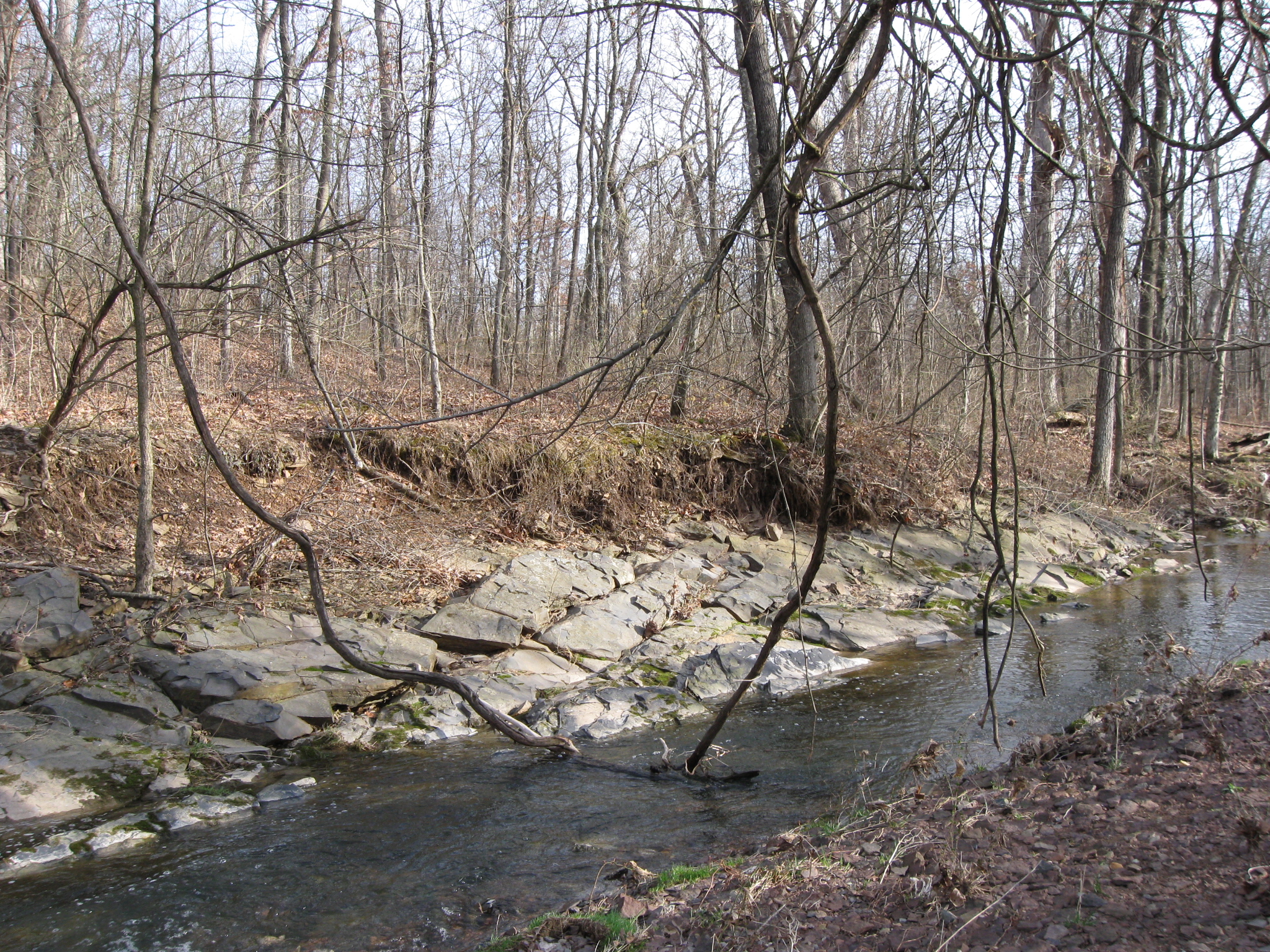
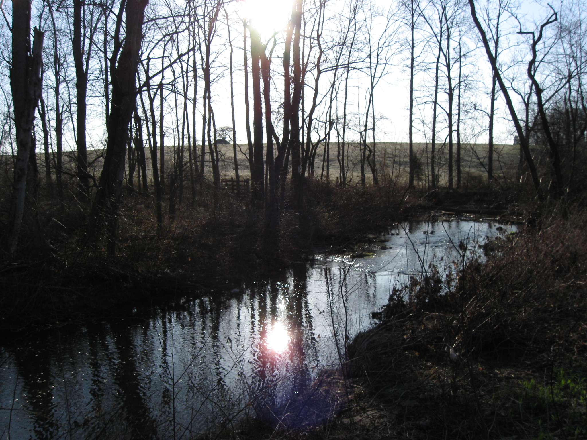
The challenge now is to cross Willoughby Run during this time of year when there is a lot of water without becoming a part of Willoughby Run. We're going to go down to where the vines are dangling into the run. This view was taken facing south at approximately 5:15 PM on Saturday, March 26, 2011.

Ok, that worked, and we're now on the west side of Willoughby Run. This image was taken facing southeast at approximately 5:15 PM on Saturday, March 26, 2011.

The trail down which we meandered to get to Willoughby Run is in the right background. The quarry is on the left side (north side) of the fence. This image was taken facing northeast at approximately 5:15 PM on Saturday, March 26, 2011.
If the National Park Service follows through with its plans of restoring the Country Club property to its 1863 appearance, then this building will go. This image was taken facing south at approximately 5:15 PM on Saturday, March 26, 2011.

Scattered throughout the property, but especially near Willoughby Run are these golf balls, which because the National Park Service now has the land must be artifacts. We're going to start the rumor that is one the last ball sliced into the woods by President Eisenhower on his last round of golf at the Gettysburg Country Club. This view was taken facing east at approximately 5:15 PM on Saturday, March 26, 2011.

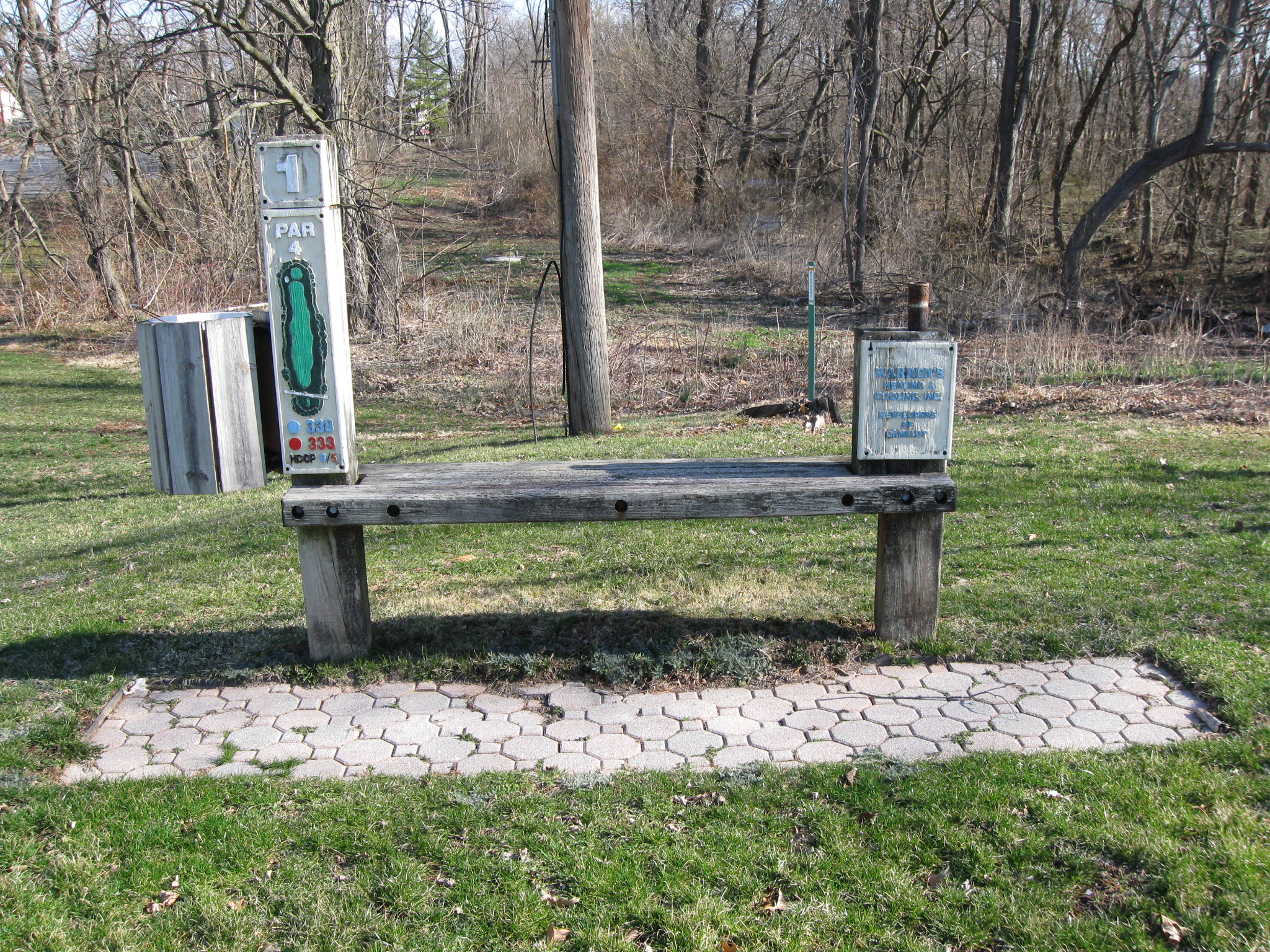
Here's the first hole which is located, of course, near the clubhouse. This view was taken facing north at approximately 8:30 AM on Saturday, March 26, 2011.
We're looking from the tee off area down the fairway of the first hole. On July 1, 1863, Archer's Brigade, and later Pettigrew's Brigade would have charged across this ground from right to left towards Willoughby Run and later up McPherson's Ridge. This view was taken facing southwest at approximately 5:15 PM on Saturday, March 26.

Willoughby Run is on the other side of the first group of trees. The West End Guide Station on West McPherson's Ridge is in the left center background. The McPherson Barn on West McPherson's Ridge is in the center background. The group of trees on the other (east) side of Willoughby Run are growing out of a quarry, but not the quarry in McPherson's Woods. Katalysine Springs would have been farther to the left, out of sight. It was near Willoughby Run and closer to the Chambersburg Pike. This view was taken facing east at approximately 5:15 PM on Saturday, March 26, 2011.

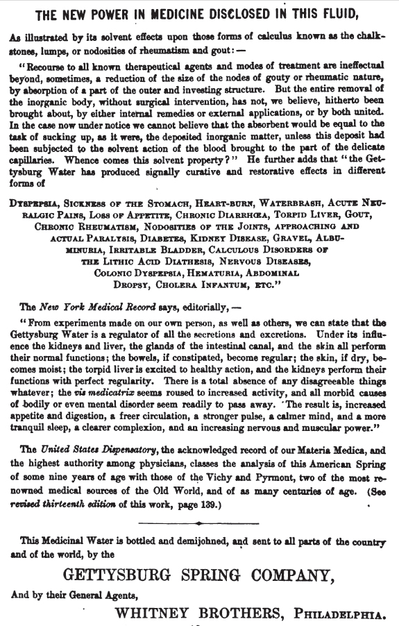
The springs would have been to the left of this area near Willoughby Run. The roof of the West End Guide Station is barely visible in the center background. The Reverend Charles G. McLean, on whose ground the springs were found, attempted to interest local residents in them as early as the 1830s. In 1868, the Gettysburg Lithia Springs Association began bottling and selling the "medicinal waters." The white building is on the newly acquired Country Club land. The pamphlet/booklet "Mineral Springs of North America" by J.J. Morrman, M.D., Physician to the White Sulphur Springs, stated: "This spring is located one mile west of Gettysburg, Adams County, Pennsylvania. It rises in a portion of the battle-ground made famous by one of the most san- guinary struggles of our recent civil war. If not en-tirely unknown as a water possessing curative powers, it was unknown to the fame it now enjoys, until after its surrounding hills were moistened by the fraternal blood of contending hosts. The legend of the place, that the virtues of the waters were first demonstrated by wounded soldiers who fell in battle in the vicinity of the springs, is probably more romantic than true. But there is little doubt that the distinction which the famous battle gave to the ground in which the spring is situated did much to direct attention to the spring and to lead to a more thorough examination of its waters." Appleton's Illustrated Hand-Book of American Summer Resorts stated that "the waters... are especially valuable for diseases of the kidneys and bladder." This view was taken facing east at approximately 8:30 AM on Saturday, March 26, 2011.
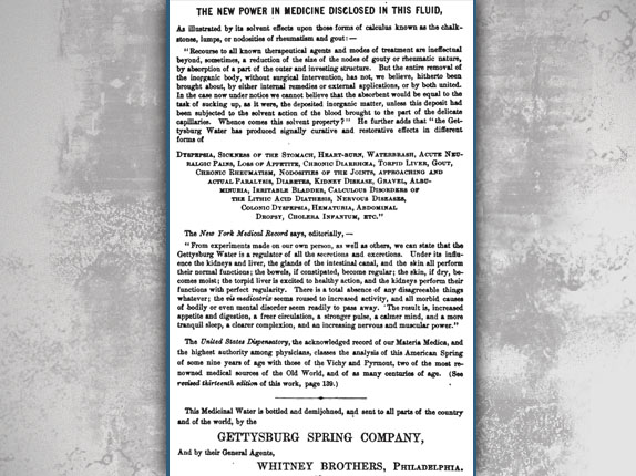
Here's how the owners of the Spring advertised its healing qualities John B. Bachelder's Bachelder's Illustrated Tourist Guide of the United States, published in 1873. The Gettysburg Lithia Springs Association also established a bottling plant for the healing "medicinal waters" that they were selling.
If you're a Gettysburg Licensed Battlefield Guide, there are advantages of being "low" in the draw. The draw is the method that chooses who will go out first with visitors each morning. Those of us who were low or at the bottom of the draw had some time to look over this newly acquired land. We are following Cliff Detweiler (closest to the camera), the black hatted Dr. John Krohn, and John Zervas down a sewew line access that conveniently runs parallel to Willoughby Run. The Daniel Boone of the group, Rich Bellamy, is not shown as he was out blazing his own trail through this wilderness. This view was taken facing south at approximately 8:30 AM on Saturday, March 26, 2011.
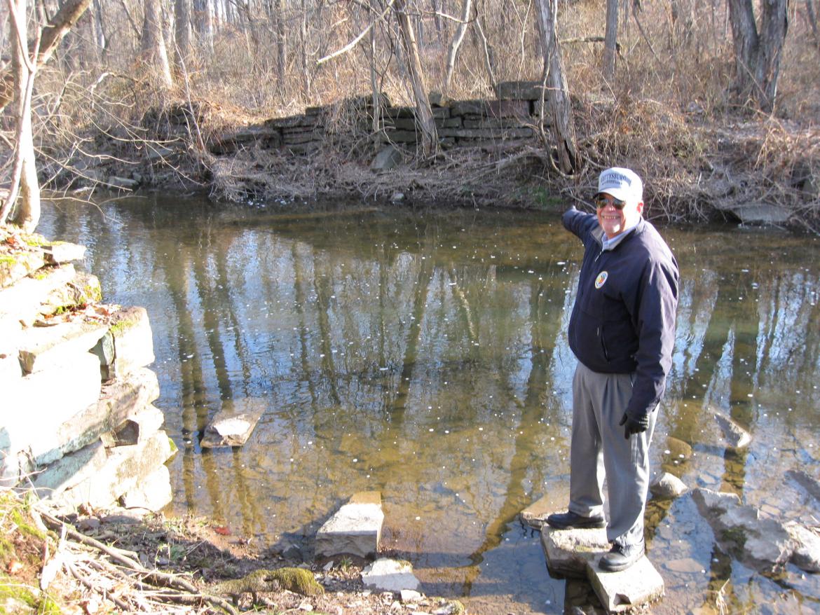
John Zervas is pointing to the remains of a bridge foundation on the east side of Willoughby Run. This image was taken facing northeast at approximately 8:45 AM on Saturday, March 26, 2011.
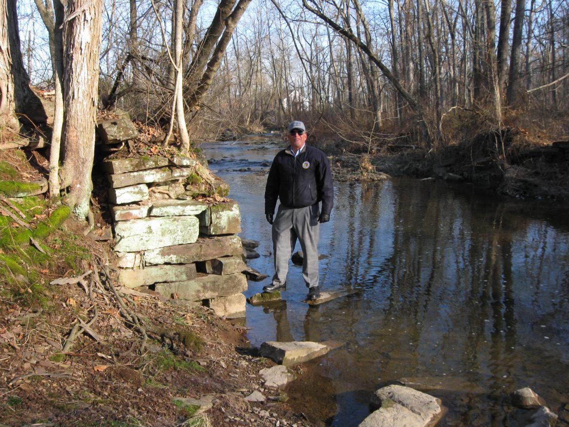
John Zervas is standing by the bridge foundation on the west side of Willoughby Run. The bridge carried a horse-drawn trolley line over Willoughby Run. The trolley picked up passengers at the Gettysburg Railroad Station, brought them over Seminary Ridge on the specially constructed Springs Avenue, and over Willoughby Run (at this location) to the Katalysine Springs/Gettysburg Springs Hotel. This image was created facing north at approximately 8:30 AM on Saturday, March 26, 2011.
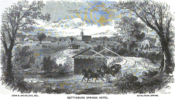
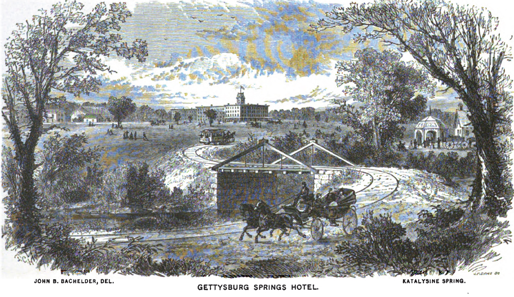
Thanks to John B. Bachelder, we have a good view of how this area appeared. Notice the carriage in the foreground using the ground also traversed by the horse-drawn trolley that is going up the slope towards the hotel. Notice the structures on the right and left of this view. This health resort/spa was built over three months in the spring of 1869 by the Gettysburg Katalysine Springs Company. The other structures might have included some summer homes built by investors. The spa closed in the 1890s. Notice how the road on the other (west) side of the road is raised above the rest of the ground for the trolley line. Besides being low ground by the run, the company had created a lake in this area by damming up Willoughby Run. This image was created facing west circa 1873 for Bachelder's Illustrated Tourist Guide of the United States.

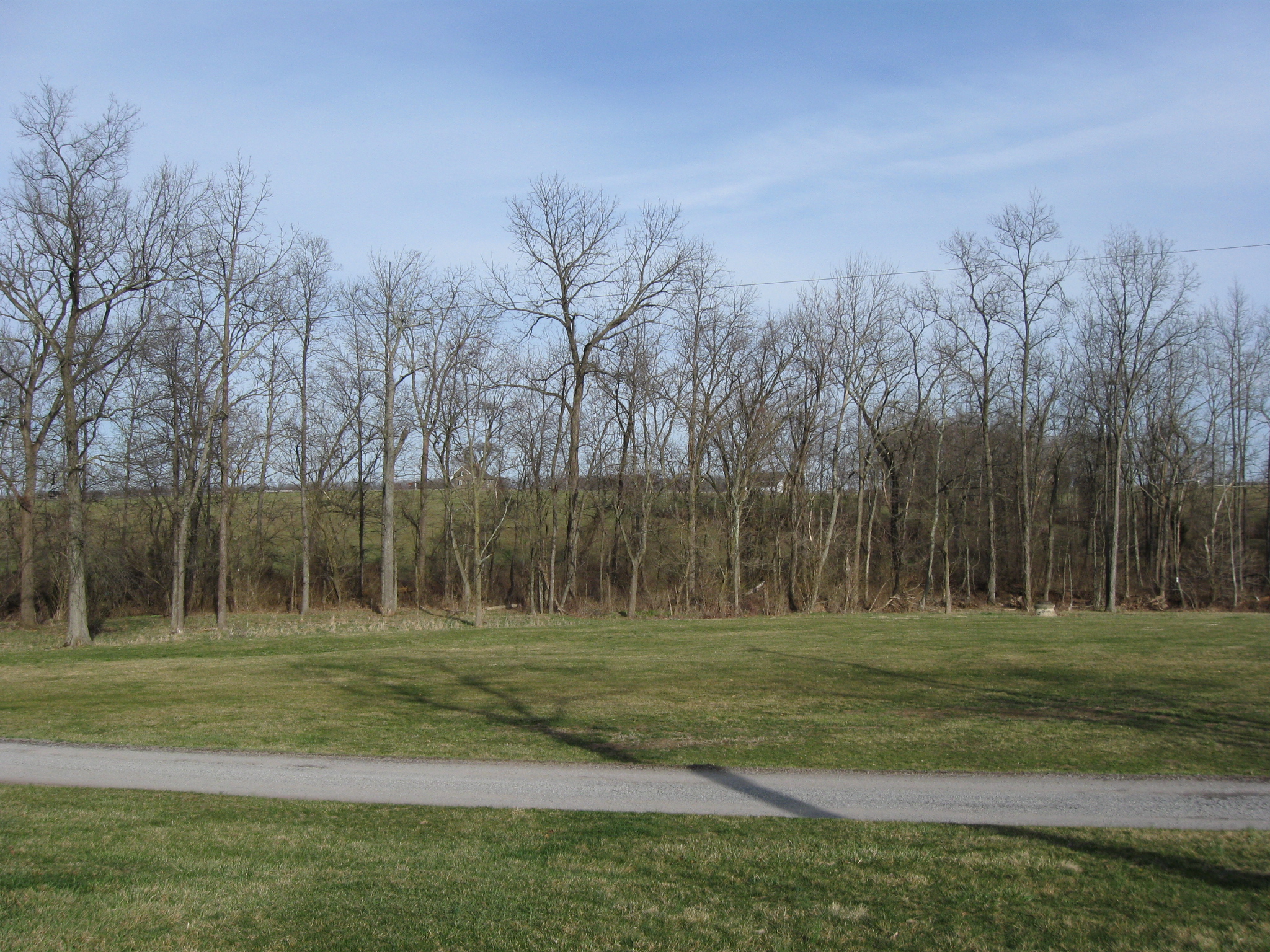
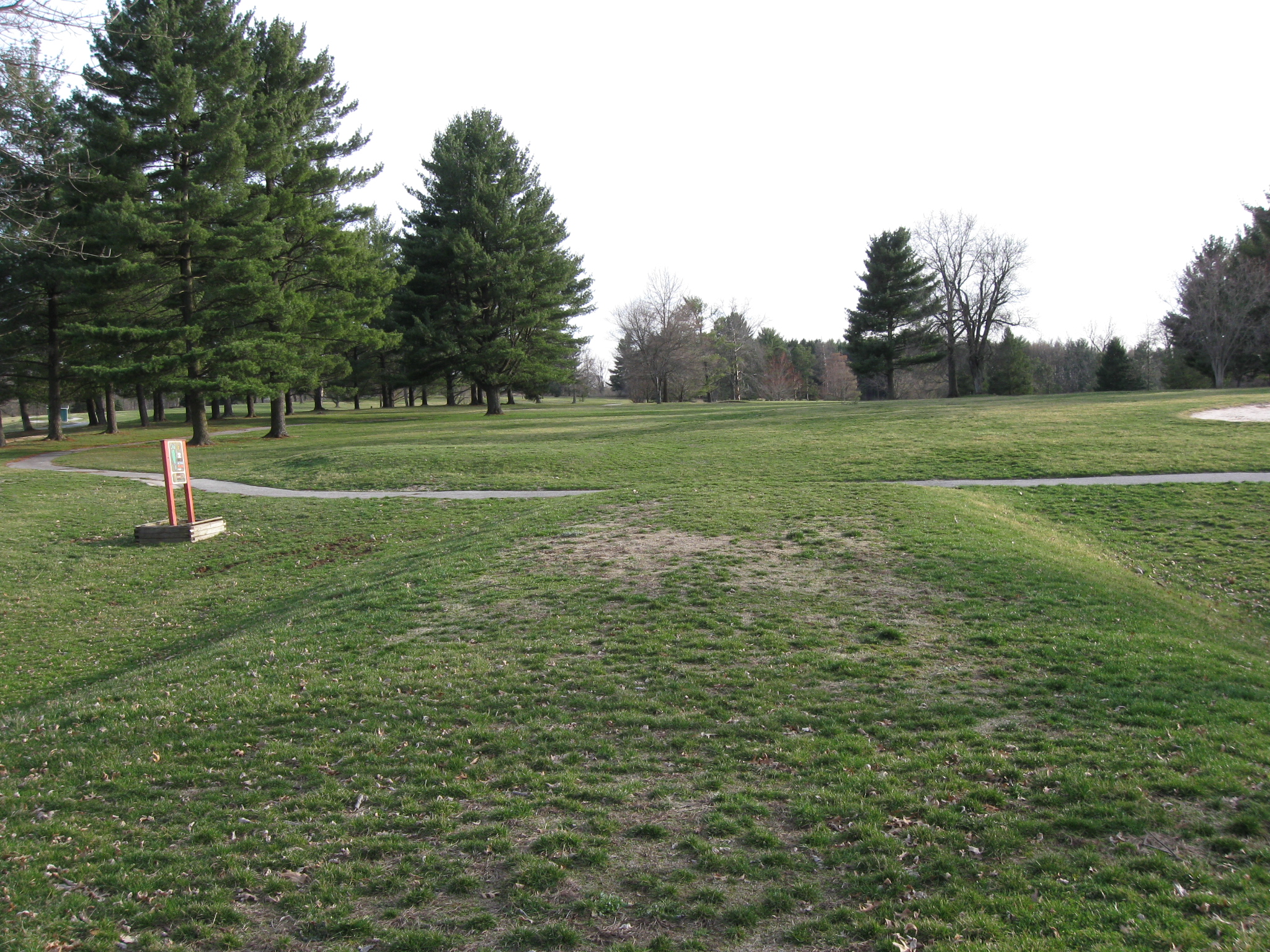
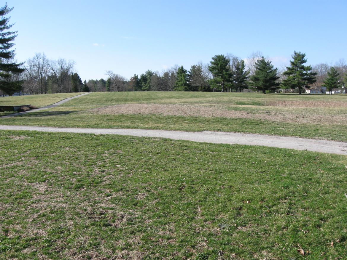
So we'll show the approximately location of where the hotel was by playing the second hole, a par 3, 156 yards. This view was taken facing southeast at approximately 5:15 PM on Saturday, March 26, 2011.

We're teeing off from here. This view was taken facing southwest at approximately 5:15 PM on Saturday, March 26, 2011.

In the area of the green and in the woods to the right would have been the location of the hotel according to the 1904 Cope Map. The hotel was a wood-framed, four-story main building topped with a two-story square cupola, a four-story back building, and a one-story kitchen. A very large dining room, a cotillion hall, men�s and women�s parlors, and a billiard room were all located on the first floor. This view was taken facing southwest at approximately 5:15 PM on Saturday, March 26.

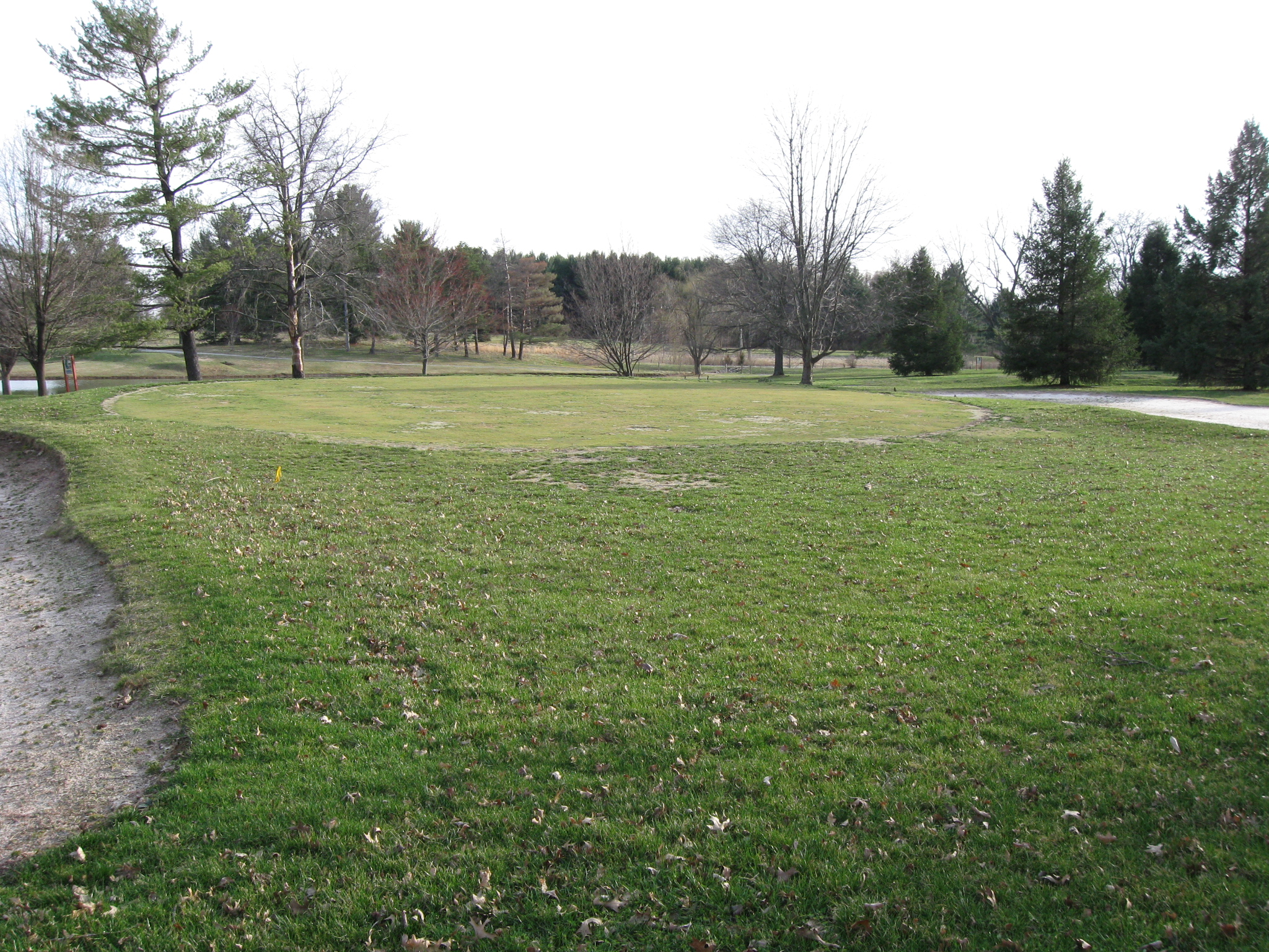
With its "elegant accommodations," a wide range of facilities and entertainment and "modern privies" for each room, the spa-resort attracted clients from near and far, especially from cities east and south. Many veterans groups having their reunions were headquartered at the Springs Hotel. This view was taken facing south at approximately 5:15 PM on Saturday, March 26, 2011.

A lake constructed by the Gettysburg Country Club is at the bottom of the rise of ground on which the hotel was situated. According to Appleton's Illustrated Hand-Book of American Summer Resorts published in 1893, "The leading hotels are the Eagle (site of the 7-Eleven Store), Gettysburg Springs, Globe (site of downtown PNC Bank), and McClellan Inn (site of Gettysburg Hotel)." This view was taken facing south at approximately 5:15 PM on Saturday, March 26, 2011.

And why wouldn't people come here when you have Governor Andrew Curtin of Pennsylvania and Major General George Gordon Meade attesting to the value of the resort and medicinal spring. This advertisement appeared in John B. Bachelder's Bachelder's Illustrated Tourist Guide of the United States, published in 1873.

We're all for restoring the battlefield back to how it looked in 1863, but if you cover up this pond, you really miss the opportunity to reenact Civil War water and sea battles such as the Monitor and the Merrimack or the Alabama and the Kearsarge. Or since Gettysburg National Military Park also is connected with the Eisenhower National Historic Site, how about some World War II battles such as Midway? This view was taken facing southwest at approximately 8:30 AM on Saturday, March 26, 2011.

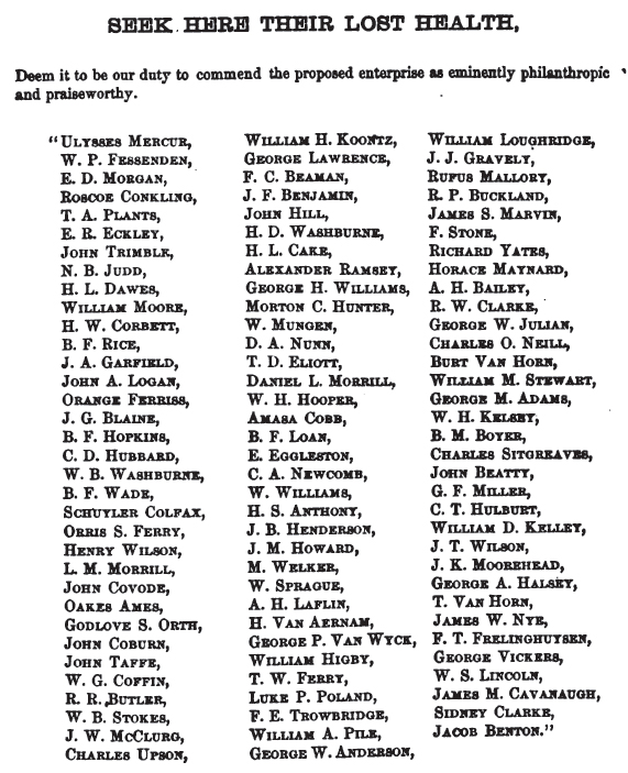
Here's a list of some prominent people who stayed at the Springs Hotel. There are lots of important people here, but at least three from the late 1800s really stand out: Roscoe Conkling, Benjamin F. Wade, and Schuyler Colfax. This advertisement appeared in John B. Bachelder's Bachelder's Illustrated Tourist Guide of the United States, published in 1873.

The 94-95 acres includes some interesting views of the property. We are on a rise of ground on the south side of the lake. On the north side of the lake, in the trees in the center background, and to the left of them sat the Springs Hotel (according to the 1904 Cope map). The company that owned the Springs Hotel went bankrupt in 1901, and a J.A. Ring, acquired the structure to host veterans during the 50th anniversary of the battle in 1913. In 1915 a company was formed to renovate and reopen the property, but after preparing attempting to prepare it for more modern improvements, those efforts failed and the hotel sat abandoned except for a caretaker. This image was taken facing northwest at approximately 8:30 AM on Saturday, March 26, 2011.

At 11:30 AM on Monday, December 17, 1917 a fire originated from a flue in the wall between the second and third floors. According to the Gettysburg Times newspaper: The fire "soon spread throughout the entire wooden structure and burned rapidly until the old frame building was a roaring mass of flames. Wide hallways helped to make drafts which fanned the fire and it was little more than half an hour from the time the fire was first seen until it had spread into every nook and corner of the big structure. It made a wonderful sight for it progressed so rapidly that the flames were shooting up around the cupola before any part of the building had fallen and the place was practically all ablaze at one time. The flames mounted high into the air and the fire could be seen from a great distance. Persons living in that section drove over the drifted roads and through fields to witness the spectacle but things were so badly drifted that comparatively few reached the place until it was down." This image was taken facing southeast circa the 1890s by William Tipton.
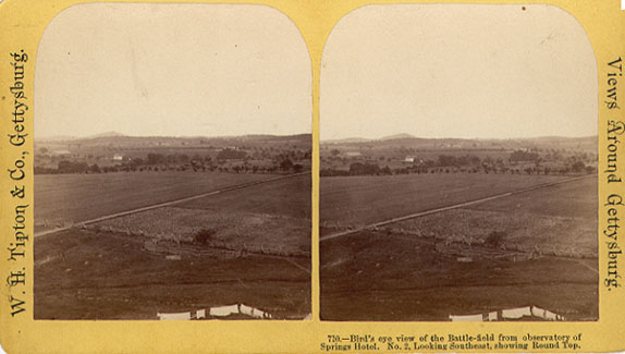
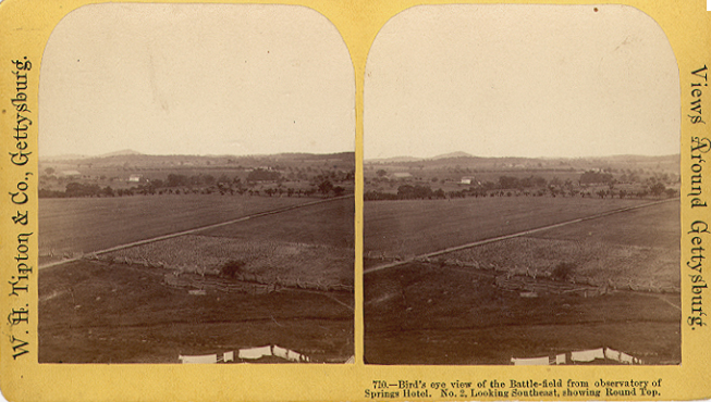
Luckily for us, the photgrapher William Tipton took a stero view from the Cupola. Big Round Top is in the left background. This view was taken facing southeast circa the 1890s.

So now we have to go back to our vehicle parked on McPherson's Ridge. We decided to go back using the pathway leading to the 24th Michigan and the 26th North Carolina monuments. We did not do well. Wet rocks really are slippery. Next time we're going to only use the trail from the 7th Wisconsin Monument. This view was taken facing northeast at approximately 6:15 PM on Saturday, March 26, 2011.